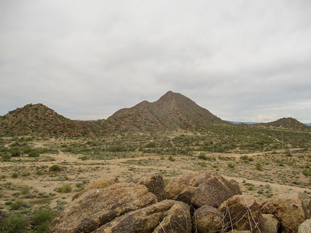
Pyramid Peak is the highest point of the Deem Hills in northwest Phoenix. It has a notably pointed tooth-like profile, easily seen from the Interstate-17 (looking west) and Loop-303 (looking south) freeways. Most of the Deem Hills are surrounded by homes and suburban development. However, Pyramid Peak lies north of the CAP Canal, which forms a boundary (and a moat), so that the land north of it is undeveloped desert.
A couple weeks ago, I climbed Ludden Mountain, the second-biggest peak in the range and about two miles south of Pyramid. That prompted me to finally get serious about hiking Pyramid itself. I had time off for winter break, so it was easy to get my stuff together and run up here for the hike. I waited until after the rush hour traffic died down. From my home to here is about 35 miles, and the drive took about 45 minutes, which is pretty good.
I parked in the Deem Hills Park parking lot, figuring it would be less obvious than if my car was parked along the road leading to the peak. The road (Stetson Valley Road) simply ends at the canal, and parking is supposedly restricted although I am not sure how aggressively that is enforced. I did not want to take any chances though. This added about a half mile each way to the hike.
I walked a jogging path and sidewalks to where the main road ends at the canal. I crossed the bridge and a concrete barricade. This is Arizona State Trust land, and I had my permit, although it was back in my car. A met a guy walking his dog and we talked, mainly about the trash in the area here and if I was with the state lands office. I said I wasn't. Turns out there is a community effort to clean up the area from the trash dumpers.
We parted ways. I headed northwest following random tracks etched into the desert. Judging by the tracks it seems a lot of bicyclists ride up here but some tracks looked like they see ATVs, too. There was a lot of general trash: clothes, random tires, wood scraps, and so on. It was not terribly pretty right where I was.
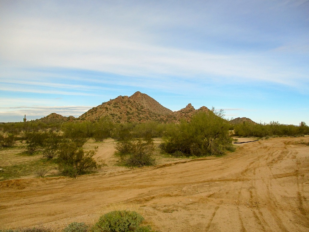
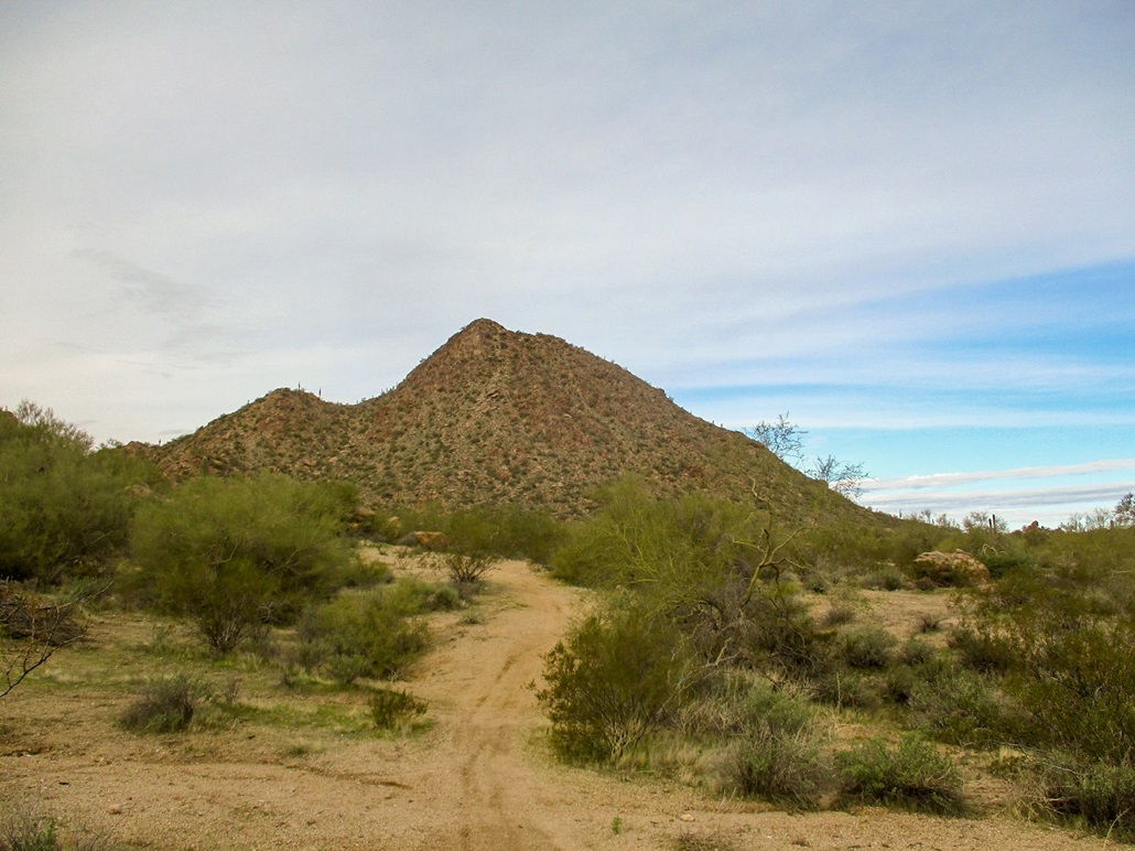
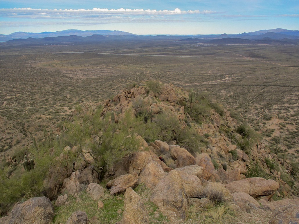
I walked about a mile until I was northeast of the peak. Having read what information I could find, previous hikers have suggested to climb this peak from its north side. When viewed from below, all sides look steep and challenging. I placed myself at the base of a steep slope, facing more east than north, roughly under the letters "Pe" in "Peak" on the topographical map. It looked steep but manageable, no cliffs or other barriers evident. I was about 500 feet below the top.
I took a break, then just started hiking up the slope. The brush was light and the rocks, mainly granite with pebble-sized grus gravel, were spaced conveniently. The slope lay back reasonably well and I was able to get up a couple hundred feet with no issues at all. The rocks were solid, very few moving under my weight. The brush was easy to avoid and there were always options when confronted by some barrier.
About halfway up the slope, it steepened noticeably, pushing 45 or 50 degrees now. The upper ridge was lined in rock outcrops as was a softer ridge to my left. The two ridges lined the slope and appeared to converge above me, the slope forming a ramp with a left-ward bend.
The climbing itself was not technically challenging, but it was steep. I was able to sniff out routes that required hands for balance but no actual scrambling. I would not rate any segment of my route as Class-3, but there were a few times I needed to use my hands to hoist up a segment, or to literally crab-crawl a few feet when I encountered looser scree. But I was able to move upward consistently.
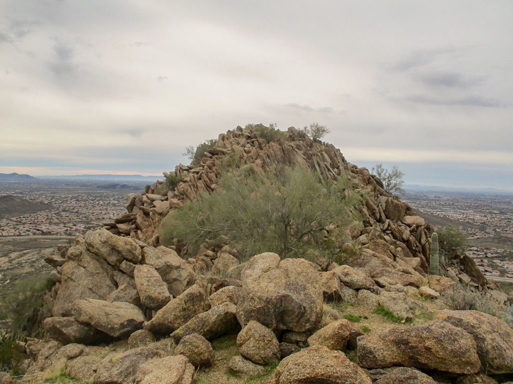
Where the slope bent left, I angled to the upper rocks, which provided surer footing. Soon, I was on top the ridge, but not really sure where I was. There appeared to be a summit just ahead of me, but I was aware there is a false summit north of the actual highpoint. I scampered up to this viewpoint and was pleased to see I was at the north false summit. I was essentially done with the uphill grind.
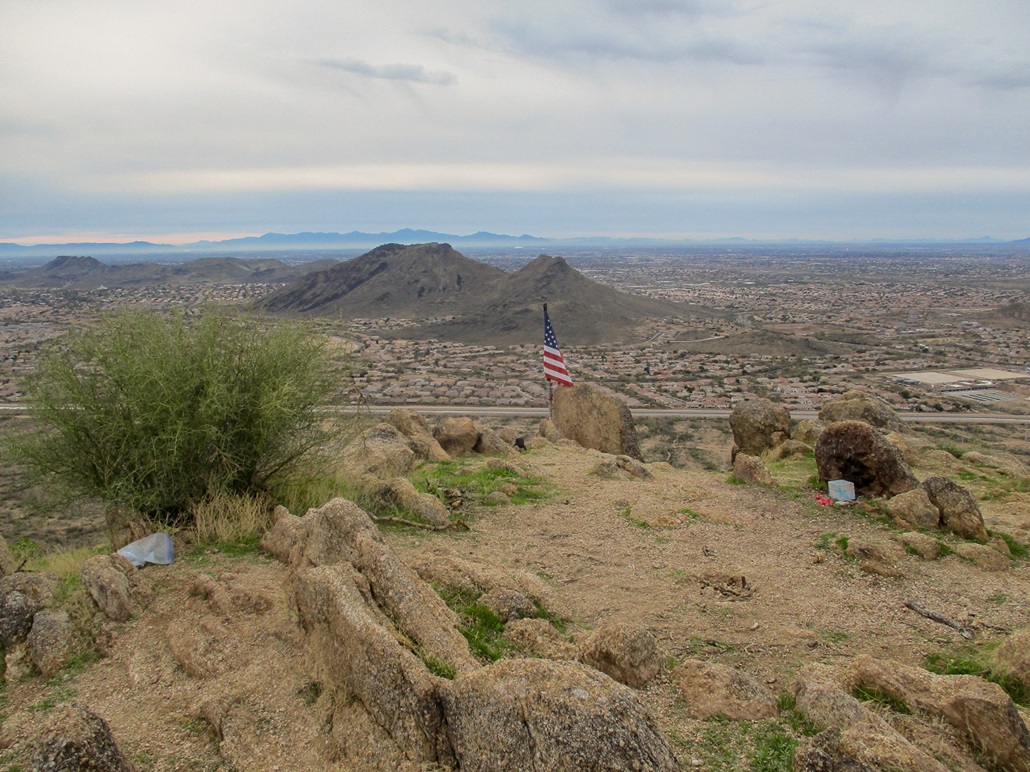
From the north summit, I dropped about 15 feet to a saddle, then found a stair-step path through the rocks to gain the highpoint itself. I was happy to be here, and I took a five minute rest. There is a flag up here and it looked new so someone must come up here to look after it. I signed into the register (a geocache). I was the first to sign in since earlier in the month.
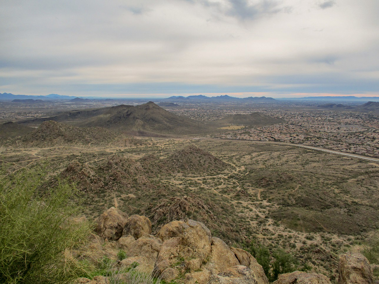
The day had started out sunny with some cloudiness, but by the time I arrived on top, the blue skies had disappeared completely. I snapped a few images anyway, knowing the images won't come out that well. I took a moment to identify a few surrounding peaks such as Ludden Mountain and the rest of the Deem Hills, the Bradshaw Mountains to the north, Daisy Mountain and the McDowells to the east. I had decent long-distance views. It was a little chilly up here.
I figured I better get moving downward before I forget what I did. I got off the rocks easily and situated myself at the top of the steep slope. Then, I slowly scooted down the thing, a few feet at a time. I did whatever it took to move safely, using my trekking poles, using my hands, sometimes using my butt. I was able to inch downward without a single slip, but I went slow.
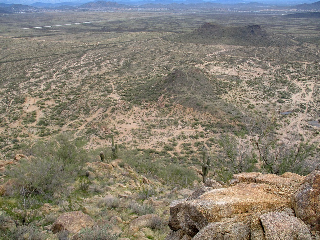
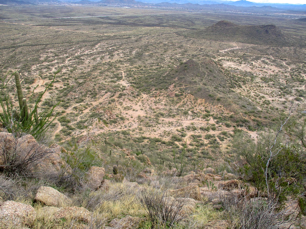
Back on the desert flats, I walked a little east and planned to hike a smaller hill, a borderline ranked summit nearby the canal. I got about halfway up and took some photos, but decided I was not interested in more steep-slope-scampering. I was quite pleased to have been successful on Pyramid Peak!
When I neared the bridge, there was a guy there picking up trash. He was with the state lands office, with a truck and a trailer to haul away the trash he was picking up. We talked a little bit, and he gave me a brief run-down of the area and the problems they face with trash-dumpers. The locals who live nearby probably aren't the culprits because there's no way to drive across the bridge. The dumpers probably come in from the north and west where there are no barriers.
The hike had taken me two and a half hours, which surprised me a little, but I did go slow on the steep slope both up and down. I would also recommend to approach from the north and choose routes carefully. It can be made as easy as a very steep slope hike. The other sides look about the same but they seemed to have small cliffs as well.