Heading out the door? Read this article on the new Outside+ app available now on iOS devices for members! Download the app.
It rains 262 inches a year in the Great Bear Rainforest—that’s 22 feet, roughly the height of a giraffe. It rains for whole days and whole months, in mists and fogs and drizzles and spits and downpours. It comes in hurricanes spun off like angry orphans from Hawaiian Pineapple Expresses and Siberian Southwesters. A proper atmospheric tantrum can uproot and polish a Sitka spruce into a 200-foot-long toothpick. Sometimes it rains 356 days out of the year.
Lies, I now suspect. At minimum, I’m convinced it’s a clever smokescreen to keep hordes away from a hidden tropical paradise, a bit of local hokum meant to keep Sandals Resort from setting up a far-north outpost. If the “scientists” are right, my five straight cloudless days of kayaking through Caribbean-blue inlets to ivory-sand beaches means I’ve taken almost all the sunshine for the year in one mid-August gulp. I have to dive into the 55°F water to remember I’m not in Bermuda.
But my guides are impressively committed to keeping the tall tales alive. “Really, this isn’t normal,” one says. “They usually call it ‘Fogust’ around here.”
On every wilderness trip, it’s important to be prepared for unexpected conditions. But somehow I forgot to pack extra sunscreen.
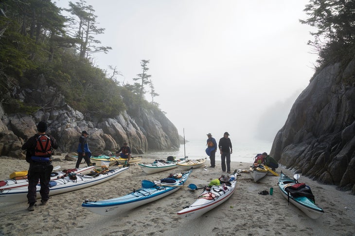
Beaches like this one in the Serpent Group make for easy entry into the water
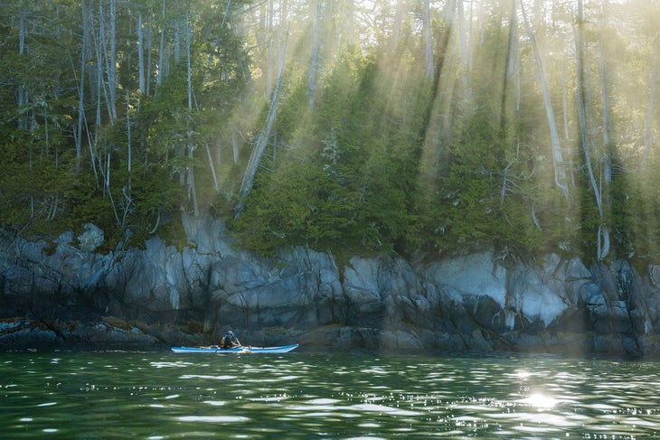
The sun burns off the fog as guide Daniel Nammour paddles on day seven.
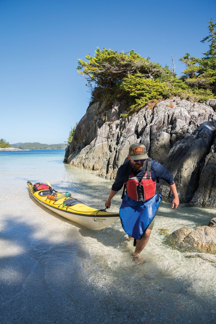
Landing on a hidden beach in the Serpent Group
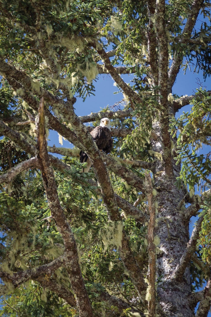
A bald eagle visits camp in the McMullin Group.
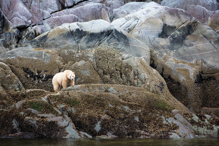
A spirit bear (though none were seen on this trip, since the islands are not good habitat)
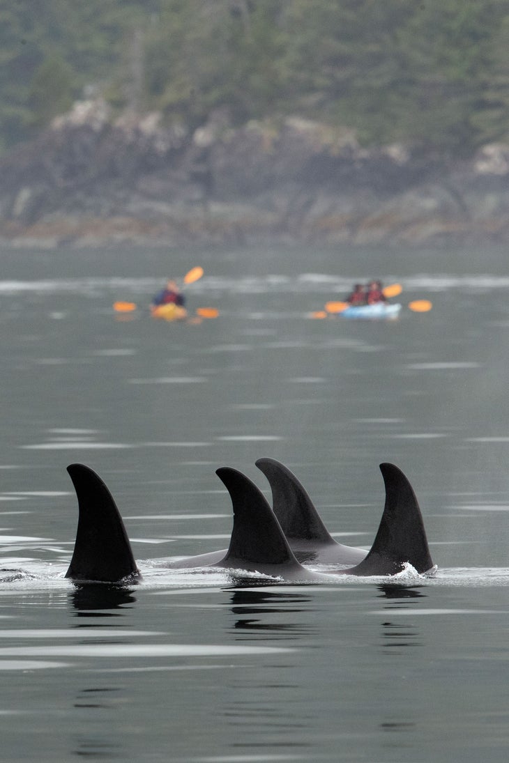
Paddling with orcas
I’ve long been drawn to the central British Columbia coast, a nameless stretch of wild between Vancouver Island and Alaska. On a topo map, the maze of veiny passages and dense peaks looks like crinkled aluminum foil. The region harbors a particularly huge, particularly dense patch of temperate rainforest—the largest remaining swath in the world. Roughly the size of Ireland and twice as green, this mossy Amazon is home to only about 20,000 people—and lots and lots of animals. A profusion of grizzly bears, crab-eating wolves, cougars, eagles, and other wildlife live in densities higher here than almost anywhere else. Most otherworldly is the Kermode bear: a rare, white-furred version of a black bear also known as a ‘spirit bear.’ Between 100 and 400 live only here.
That’s just the life above the surface. Below, some of the fastest, most powerful tides in the world firehose nutrients into the waiting mouths of sea anemones, mussels, clams, scallops, sea stars, octopi, and fish. Whales and sea otters and seals make frequent appearances. There are too many things under the sea to name, but it’s hard to argue that anything is more important than salmon. There can be as many as 22 million sockeye in a single spawning season, feeding everything from human beings to 9,000-pound orcas. Inland, bears leave the fish carcasses in the forest, fueling giant, 1,000-year-old trees with nitrogen.
This all sounds like a classic pristine wilderness, but, in fact, the Great Bear Rainforest has been inhabited for a very long time. In 2015, scientists discovered ancient footprints buried in the sand of Calvert Island, detailed enough to make out arches and toes. They carbon-dated those footprints to 13,000 years ago—among the oldest in North America. The discovery helped resolve a longstanding archaeological mystery: Scientists had wondered how human beings had crossed ice-plastered Canada after entering the continent via the Bering Land Bridge. These footprints showed that they’d hugged the coast, where the Great Bear remained ice-free, sustaining southbound early humans with its ecological bounty and temperate climes. And it appears some of them discovered what I had—that a sunny day here is worth 40 elsewhere—and their descendants became the Heiltsuk Nation, who still live here today.
In the intervening centuries, the region’s wealth didn’t go unnoticed by logging, fishing, and other extractive interests. But in 2016, a movement led by Canada’s First Nations and environmentalists succeeded in convincing the British Columbian government to protect 85 percent of the Great Bear Rainforest. Because of that effort, exploring the Great Bear still means seeing North America as the very first immigrants did.
There’s really only one way to trace that journey, and that’s by water. That’s what I’m doing in August, on a weeklong journey with Spirit of the West Adventures, a Vancouver Island-based outfitter. Thick clouds follow us on the water taxi from the outpost of Bella Bella, a First Nations town where I count seven bald eagles fighting 12 ravens for rotting salmon on the rocks by the dock.
The co-captain of our water taxi is a burly Heiltsuk named Russell Windsor, who wears a bright-red sweatshirt, flip-flops, and shorts. “Welcome to the Heiltsuk Nation,” he booms. “Two things to know: no fish farms, and no pipelines.” This is a point of pride for the Heiltsuk: For the entirety of their history, they’ve had to fight to protect the spoils of their land, first from Haida raiders, then colonists, then industrialists. The establishment of the Great Bear Rainforest and the foiling of the Enbridge pipeline and its millions of gallons of tar-sands oil are the latest victories.
The water taxi deposits me on Snipe Island with 10 other guests and hundreds of pounds of gear and food. The clouds have evaporated and a late afternoon sun bathes our camp in golden light. “I’ve led trips here and had 10 straight days of rain,” says Daniel Nammour, our tall, blonde guide from Texas who writes Western film scripts on the side. “Doesn’t matter. It’s still my favorite place on Earth.”
We sink our feet into sand the color and texture of vanilla bean ice cream. A miscommunication means we’re one tent short, so I tarp it al fresco on a lonely stretch of beach and hope to see the Pleiades meteor shower, which peaks tonight. Black clouds roll in to blot out the stars, but when I look down, my footsteps sparkle: Bioluminescent plankton must have washed in with the last high tide. Our group of fit, adventurous retirees has already gone to bed, but I stay up late skipping, tracing words in the glowing sand, and dancing in my own private “Billie Jean” music video.
It doesn’t take long for the wildlife to come say hello. Our first day of proper paddling takes us through fields of kelp and eelgrass fringing a bony, driftwood-choked coast. About the time we tire of counting bald eagles, Leah Chandler, Daniel’s colleague, spots a sea lion cruising under our boats. It bursts out of the water about a foot away. I can see the hulking pinniped’s eyes go cartoon-character wide as it startles and abruptly somersaults away with a splash.
After five hours on the water, we pull up to camp number two at the north end of Goose Island, near a dilapidated longhouse with a fire pit. Heiltsuk kids gather here for youth camps, exploring the island’s 1,000-year-old bent cedars and huckleberry thickets to reconnect with their land.
Fresh wolf tracks freckle the beach. When a dead sea lion washes up about 25 yards from my tarp, Daniel goes into naturalist mode to explain that wolves here rely on dead things to survive, and that naturally makes them curious about anything lying on the beach. “Don’t be surprised if they come by to tug at the foot of your sleeping bag,” he says. He bids us goodnight, and I wonder if he’s joking—about the wolves, the rain, everything.
I awake with all my toes, and after breaking camp we drag our boats into the ocean. We cluster together to cross Golby Passage, an open-water channel dotted with hidden, wave-making rocks called “boomers.” We’re surrounded by fog, but the sun follows us above like a spotlight and the fog burns off by the time we reach a set of tiny islands where buoyant sea otters pinball between mats of brown-green kelp. Below, rockfish dart in the blue-green canyons, and jellyfish with bells the size of beach balls drift between streamers of bull kelp.
The water shallows and clears until I’m looking at a reef as if through glass. Crabs and sculpins skitter under my paddle as we pull ashore in low tide, and jaws drop at tonight’s camp: A white-sand beach extends in an isthmus to a smattering of tiny, RV-size islands mohawked with wind-bent evergreens. If you ignored the snowy peaks in the far distance, you could mistake this for Turks and Caicos. We spend the afternoon doing what comes naturally: tanning, swimming, reading.
Vacation ends the next day on 12 or so nautical miles of paddling to Superstition Point. The tropical weather holds, but the group fractures under the grueling distance. Everyone is struggling, and photographer Tegra Nuess gives voice to the mood. “I think I hate kayaking,” she says. “I’m not getting stronger—I’m getting tendonitis.”
We lunch (and recover) near a historic Heiltsuk beach. In fact, almost all the few-and-far-between landing spots on this rocky coast are traditional First Nations sites, with an abundance of archaeological remains. The hills around this beach are actually midden piles (centuries of clam shells and prehistoric garbage, basically). We snack on salmon salad sandwiches and pick briny sea asparagus from the ground. As wild and empty as this place looks, nearly everywhere we step is a native garden, every channel we paddle is a buffet table for an ancient way of life that still persists. This abundance fuels the potlatch, a massive traditional feast and elaborate gift-giving ceremony historically used to celebrate seasonal transitions, mark special occasions, and even resolve disputes. Basically, if you were feuding with your neighbors, you might saddle up your toughest bros into a burly, 30-person ocean-going war canoe, load it with nature’s groceries, and try to feed your foes into submission.
Despite our high-tech kayaks, I’m sure a Heiltsuk crew would crush us on the water. We struggle into Superstition camp in the early evening, haggard and bent and sore. But we’re reenergized by the sight of a humpback lazily surfacing in the pinking light. Its massive back looks serpentine and makes it easy to believe in sea monsters.
Our arms get a break the next day, with a mellow open-water crossing to reach the Serpent Group. If there’s a heart to this archipelago, this is it: a cluster of steep-walled granite barrier islands furred with salal, ferns, and berry bushes and crowned with an impenetrable forest. Daniel weaves around a headland and ducks into a keyhole entrance to a tongue of ivory sand with a small patch for camping . . . and three tents already on it. With nothing but empty beaches to ourselves until now, this is a shock. I can hear Daniel say “What the—” under his breath.
It doesn’t matter: With its paddle-up private tidepool and a nearby canyon where the sea flumes through at high tide, the spot feels like an oceanic robber’s roost, a Pirates of the Caribbean hideout. We take the potlatch approach and make fast friends with our rivals, who share space with us on the small beach. Steve Nagode, a Seattle resident who once owned a kayaking shop, has been coming to the Great Bear to fish for 25 years. He almost never sees other kayakers, and he never repeats routes.
Steve butchers a fat aqua-blue lingcod on a driftwood cutting board. After, he and his son Alex join me and Tegra to scramble up a narrow granite chimney and skirt a grippy cliff edge, 25 feet above the churning tide. We reach the outer island in time to watch the sunset over the open ocean. A lazy humpback plows into the bay between us and the next island; it looks like a gray-black school bus breaching in slow motion.
“I think it’s sleeping,” says Steve, just before its tail slaps water already twinkling with starlight.
When we leave the Serpent Group, we tackle our hardest crossing of the journey: Hakai Passage, where we are most susceptible to large swells coming off the Pacific.
“Here, there’s nothing between us and Japan,” Daniel says. We stop at a barren outcrop of islands to plan and prep.
Just then, a jet of water in the distance shoots three stories high: another whale. A few minutes pass and it blows again, closer. There could be more than one. Everyone is exhilarated except Daniel. He’d rather see killer whales out there.
“Killer whales notice you. They’re smart and can maneuver and don’t really want to get close,” he says. “A humpback is just not aware. It doesn’t care—we might as well be a piece of driftwood to them. One could plow into us like a semi.”
Hakai feels like the raw, open ocean. The sun is blazing, the winds are steady but calm, and still the swell comes in rolling, 3-foot hills. We try to stick together, but inevitably disappear into deep, blue troughs. Chop spills over my bow when I crest them. We might be feet from each other, but in the bottom of the trough, with the full Pacific bearing down on you like an office building made of water, you are purely alone.
Fighting the swells, I wonder what drove the first Americans to continue. Why forsake the bounty of one set of islands for the unknown promise of another? Was it bare curiosity or raw necessity that pushed them across the next channel, the next intimidating set of waves? I paddle harder.
When we land on Calvert Island, we’re saddle sore and salted through like brined turkeys. Our final camp is on Wolf Beach, our biggest stretch of sand yet—a mile or so of soft Hawaiian stuff. Everyone drains their last drops of wine or whiskey as we gather at the far side of Wolf to watch the sun melt into the horizon, a hallucinogenic set of oranges and purples.
I’ve spent more than a decade seeking out remote places, and this is one of the most isolated spots I’ve been—among the wildest corners of the Earth. And yet here on this island, humans have been walking for 13,000 years. It’s hard not to feel humbled by the unbroken line of human history and survival in the Great Bear, to recognize the journey of those ancestral Heiltsuk wasn’t so different from the one we just took. And to be a part of this millennia-old tradition, all you have to do is pick up a paddle. And don’t forget the sunscreen, no matter what they tell you.
Northwest Field Editor Ted Alvarez wrote about primitive survival skills in the October issue. He says grilled salmon is way better than charred mouse.
Do It
Getting there Fly (from Vancouver) or ferry (from Port Hardy) to Bella Bella. Season May to September Permit None, though many spots are sacred or off-limits. DIY trips are not recommended for any but the most experienced kayakers; ask locals about sacred sites if you go alone. Route Endless options, but try this: Get dropped off at Goose Island, follow its protected eastern shore, cross to the McMullins, and then cross east to make your way to Calvert Island. Guide Spirit of the West Adventures runs trips in July and August ($1,902). Guidebook The Wild Coast Vol. 2, by John Kimantis ($29)