File:Antioquia (1580).svg
Jump to navigation
Jump to search

Size of this PNG preview of this SVG file: 526 × 600 pixels. Other resolutions: 210 × 240 pixels | 421 × 480 pixels | 673 × 768 pixels | 898 × 1,024 pixels | 1,795 × 2,048 pixels | 1,742 × 1,987 pixels.
Original file (SVG file, nominally 1,742 × 1,987 pixels, file size: 422 KB)
Captions
Captions
Add a one-line explanation of what this file represents
Summary[edit]
| Description |
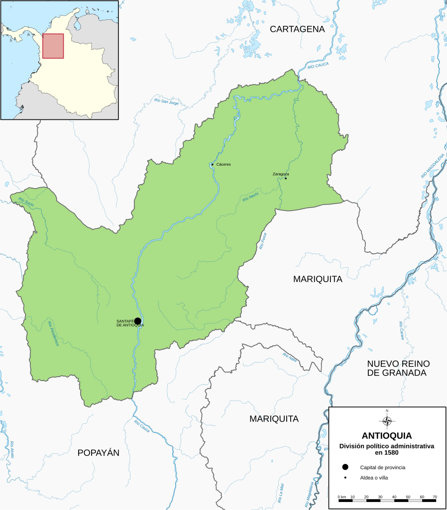
Español: Territorio y división político-adminitrativa de Antioquia en 1580 |
| Date | |
| Source | Own work |
| Author | Milenioscuro |
| Other versions |
|
| SVG development |
.svg)
.svg)
.svg)
.svg)
.svg)
.svg)
.svg)
.svg)
.svg)
.svg)
.svg)
.svg)
.svg)
.svg)
.svg)
.svg)
.svg)
.svg)
.svg)
.svg)
.svg&action=edit§ion=1)
Licensing[edit]
.svg&action=edit§ion=2)
I, the copyright holder of this work, hereby publish it under the following license:
This file is licensed under the Creative Commons Attribution-Share Alike 3.0 Unported license.
- You are free:
- to share – to copy, distribute and transmit the work
- to remix – to adapt the work
- Under the following conditions:
- attribution – You must give appropriate credit, provide a link to the license, and indicate if changes were made. You may do so in any reasonable manner, but not in any way that suggests the licensor endorses you or your use.
- share alike – If you remix, transform, or build upon the material, you must distribute your contributions under the same or compatible license as the original.
File history
Click on a date/time to view the file as it appeared at that time.
| Date/Time | Thumbnail | Dimensions | User | Comment | |
|---|---|---|---|---|---|
| current | 18:45, 7 June 2018 | | 1,742 × 1,987 (422 KB) | Milenioscuro (talk | contribs) | mejoras del mapa |
| 04:58, 1 July 2013 |  | 961 × 1,116 (262 KB) | Milenioscuro (talk | contribs) | actualizo y corrijo | |
| 09:17, 27 June 2013 |  | 961 × 1,116 (249 KB) | Milenioscuro (talk | contribs) | mejoras sustanciales de estilo, correcciones en fronteras | |
| 00:27, 6 April 2012 |  | 961 × 1,116 (540 KB) | Milenioscuro (talk | contribs) | texto a trayecto, mejoras varias | |
| 00:32, 15 February 2012 |  | 961 × 1,116 (196 KB) | Milenioscuro (talk | contribs) | {{Information |Description ={{es|1=Territorio de Antioquia en 1580}} |Source ={{own}} |Author =Shadowxfox |Date =2012-02-14 |Permission = |other_versions = }} [[Category:Maps of the history of Antioqui |
You cannot overwrite this file.
File usage on Commons
The following 21 pages use this file:
- File:Antioquia (1580).svg
- File:Antioquia (1650).svg
- File:Antioquia (1760).svg
- File:Antioquia (1800).svg
- File:Antioquia (1814).svg
- File:Antioquia (1826).svg
- File:Antioquia (1835).svg
- File:Antioquia (1843).svg
- File:Antioquia (1851).svg
- File:Antioquia (1859).svg
- File:Antioquia (1865).svg
- File:Antioquia (1885).svg
- File:Antioquia (1905).svg
- File:Antioquia (1908).svg
- File:Antioquia (1910).svg
- File:Antioquia (1930).svg
- File:Antioquia (1960).svg
- File:Antioquia (1977).svg
- File:Antioquia (1982).svg
- File:Antioquia (2010).svg
- File:Antioquia 1580.svg (file redirect)
File usage on other wikis
The following other wikis use this file:
- Usage on es.wikipedia.org
.svg&oldid=874282500)