


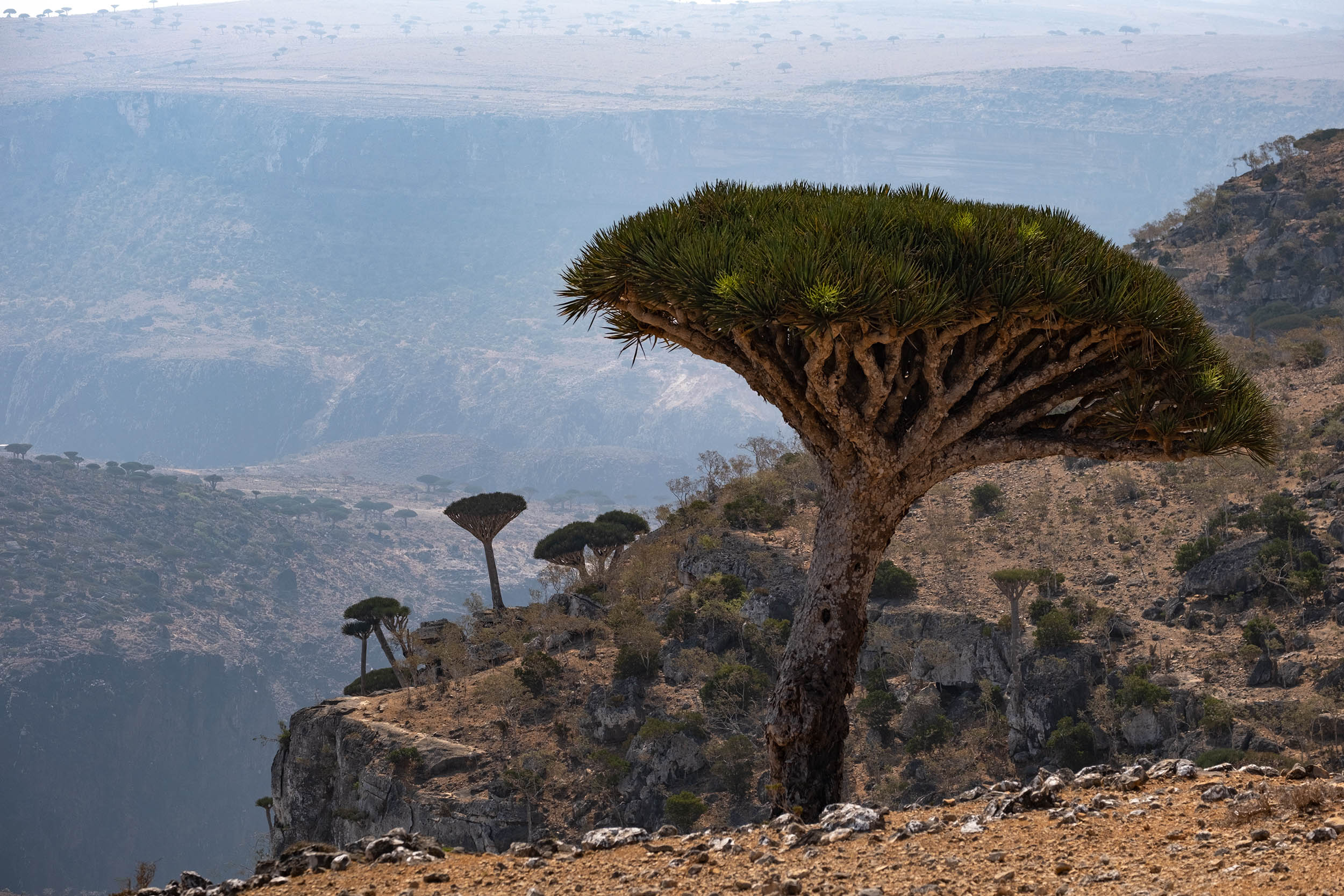
Dragon Blood, Socotra (Yemen)
Distance
230 Mi.
(370 KM)Days
10
% Unpaved
80%
% Singletrack
1%
% Rideable (time)
96%
Total Ascent
16,676'
(5,083 M)High Point
3,280'
(1,000 M)Difficulty (1-10)
9?
- 5Climbing Scale Moderate73 FT/MI (14 M/KM)
- 8Technical Difficulty Difficult
- 7Physical Demand Difficult
- 10Resupply & Logistics Very Strenuous
Contributed By

Montanus
The Wild Side
Some years ago, a television documentary caught our attention with images that showed the breathtaking beauty of a lost island adrift in the Indian Ocean, characterized by incredible landscapes and surreal flora and fauna. That was the first time we heard of Socotra, and we were planning a bikepacking trip to the remote island soon after. It’s the largest of the four islands in the Socotra archipelago, and it lies roughly 320 kilometers (200 miles) off the coast of mainland Yemen and 240 kilometers (150 miles) east of Somalia. There’s relatively little information on the internet for those intend planning an independent trip in Socotra, so this journey remained a dream for us until we eventually figured out how we could get there (check out the “Resources” tab for more).
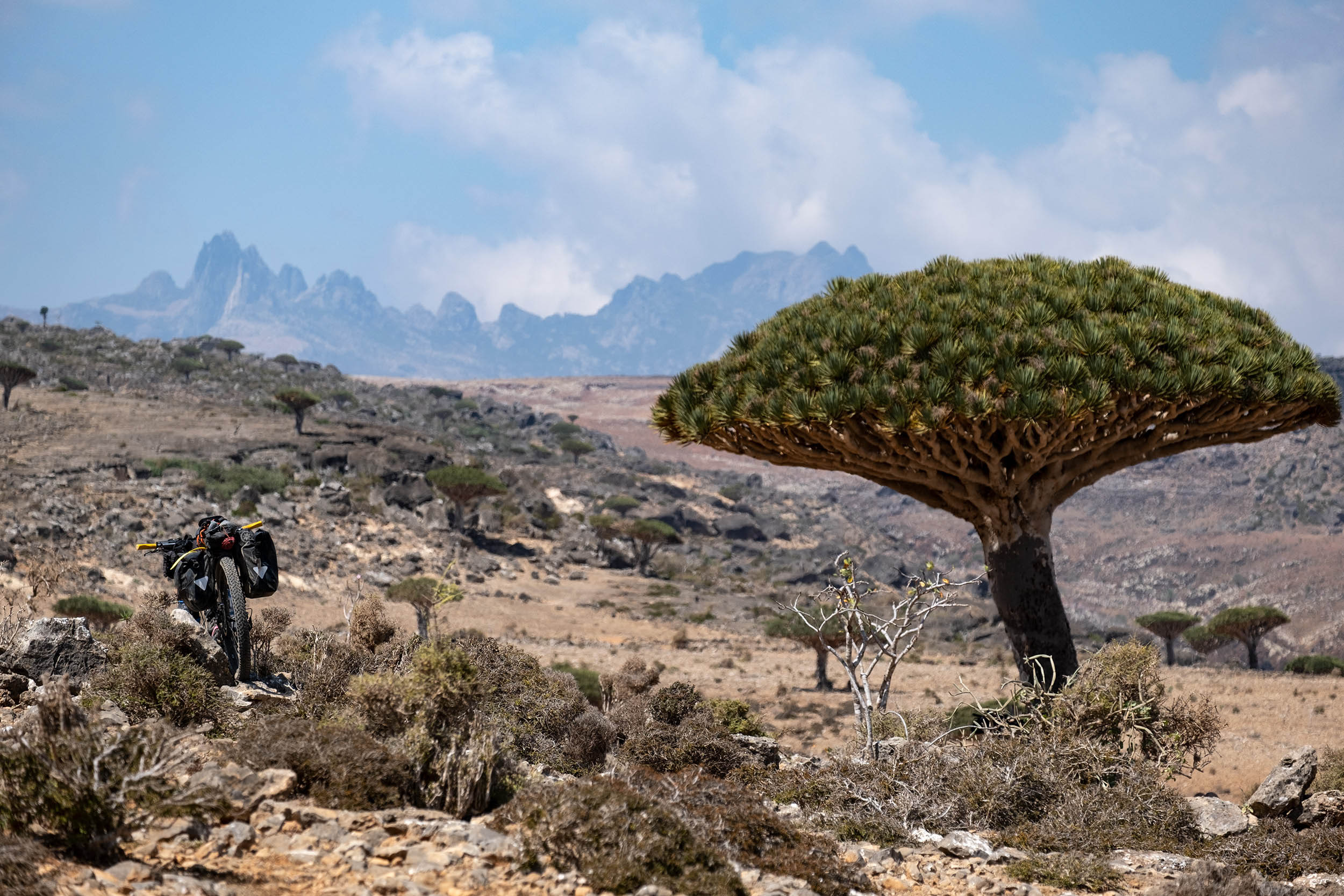
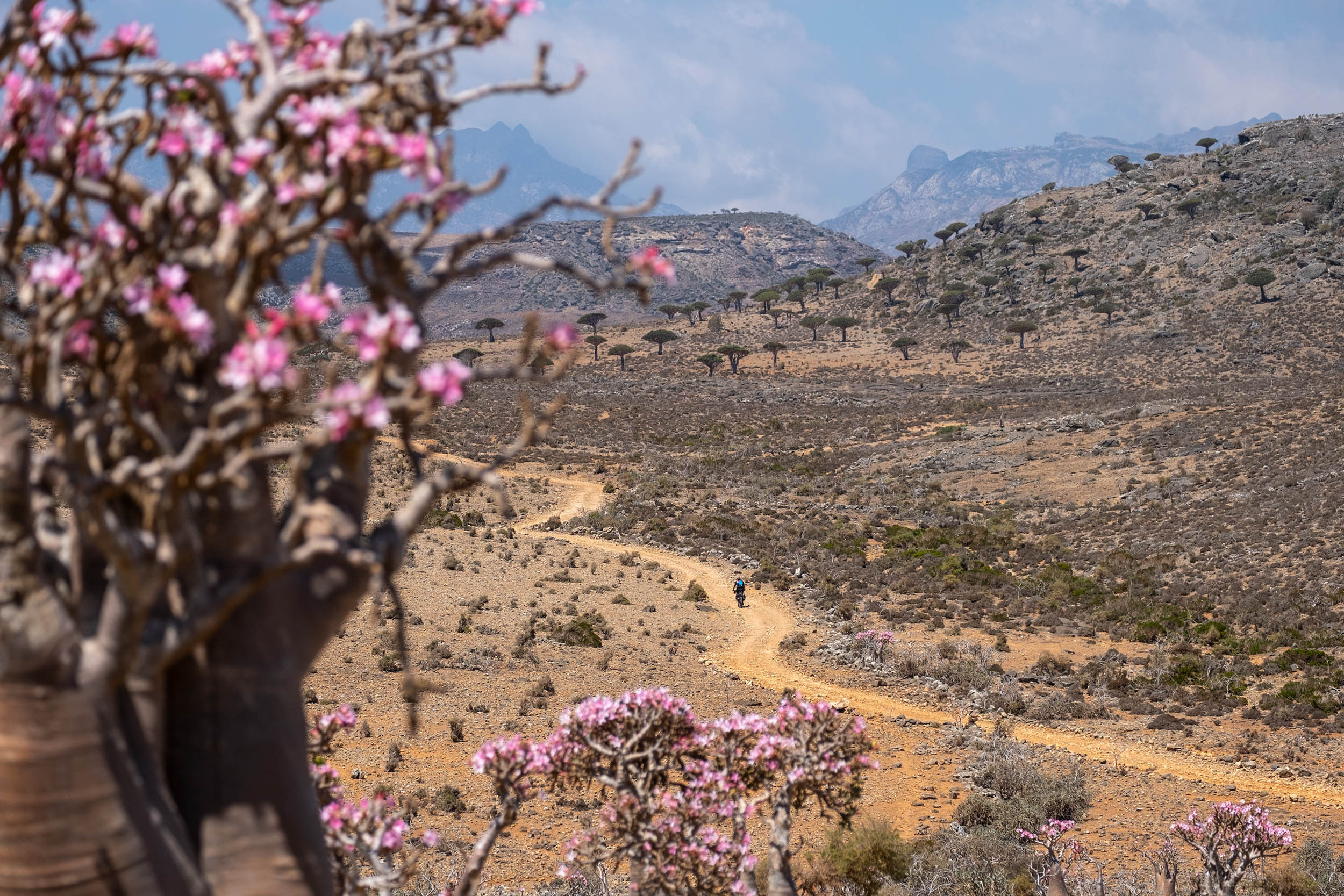
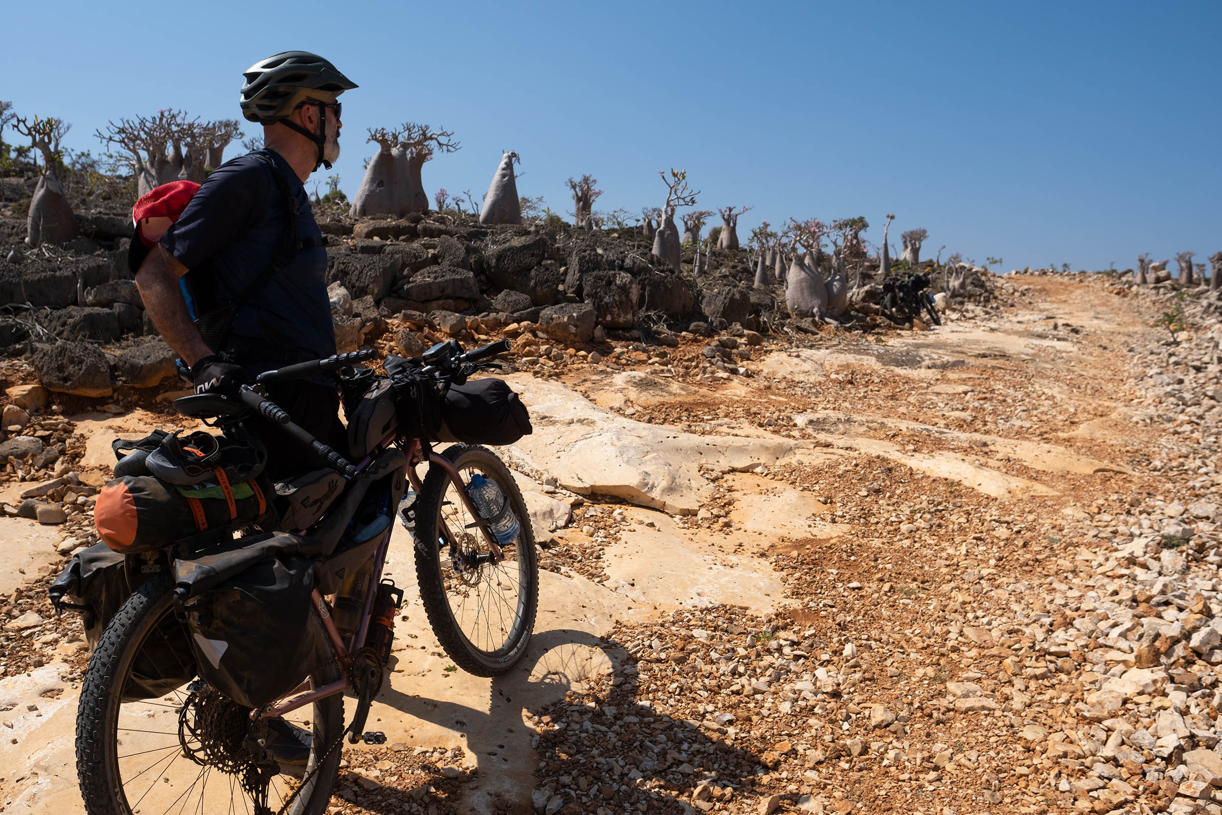
The idea behind the Dragon Blood Trail was to create a bikepacking route that takes in the wild gems of Socotra island, from the white-sand beaches and turquoise water of Detwah Lagoon to the dramatic pinnacles of Hajhir, the highest mountains of the island, rising to 1,500 meters (4,921 feet). From Hadibo, the capital of Socotra, the Dragon Blood trail flows along the coast and climbs toward Momi, an incredible plateau that seems reminiscent of Mars with its red landscapes, pyramidal mountains, limestone outcrops, and the alien-like bottle trees, an endemic succulent plant perfectly adapted for desert and rocky environment.
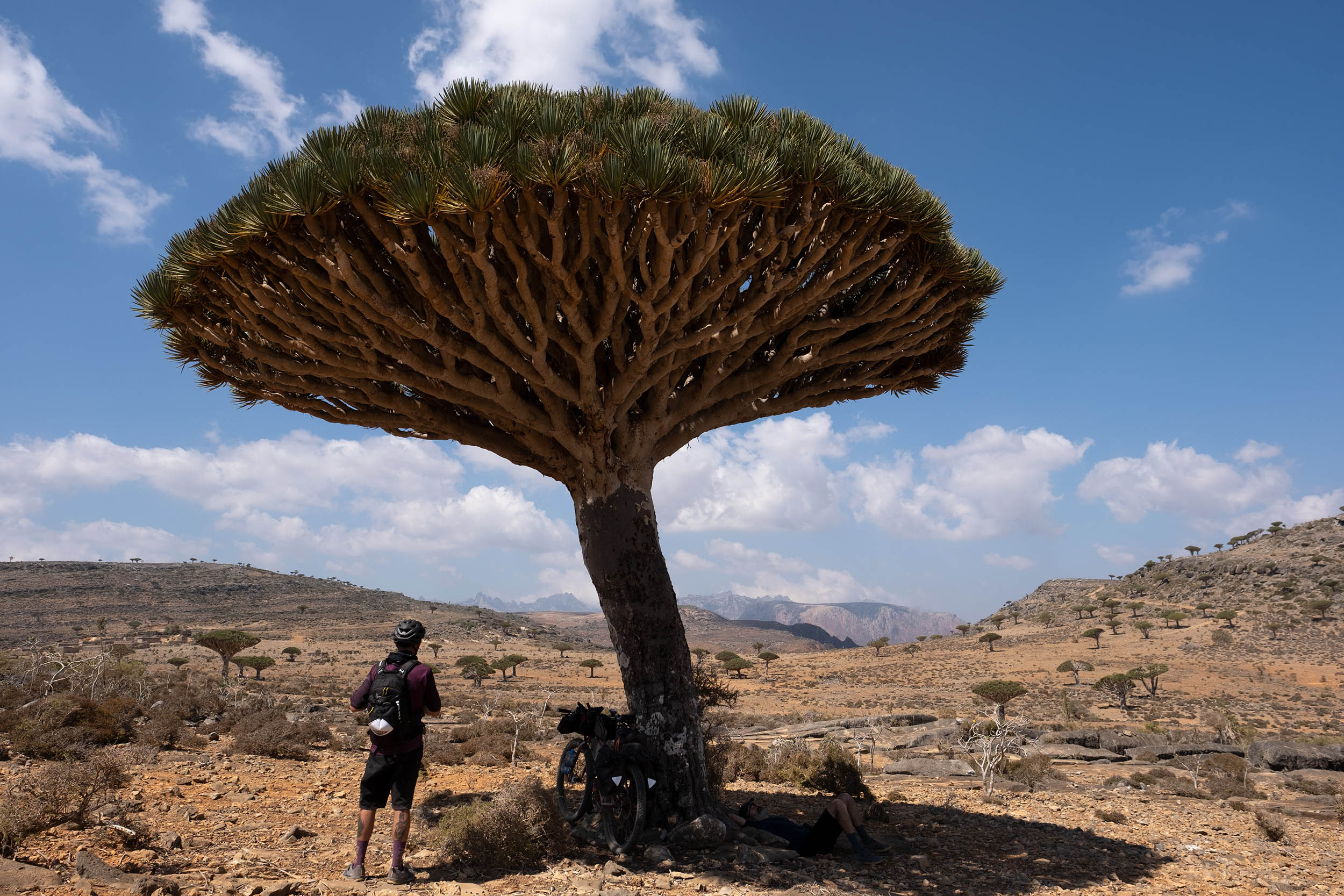


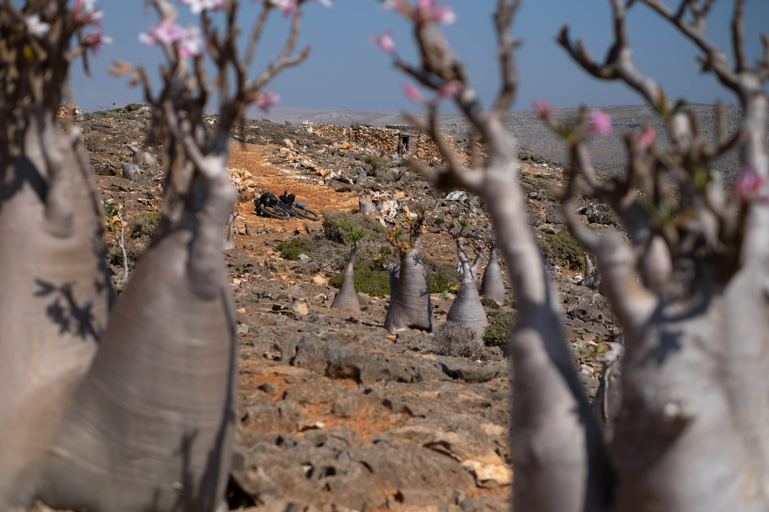
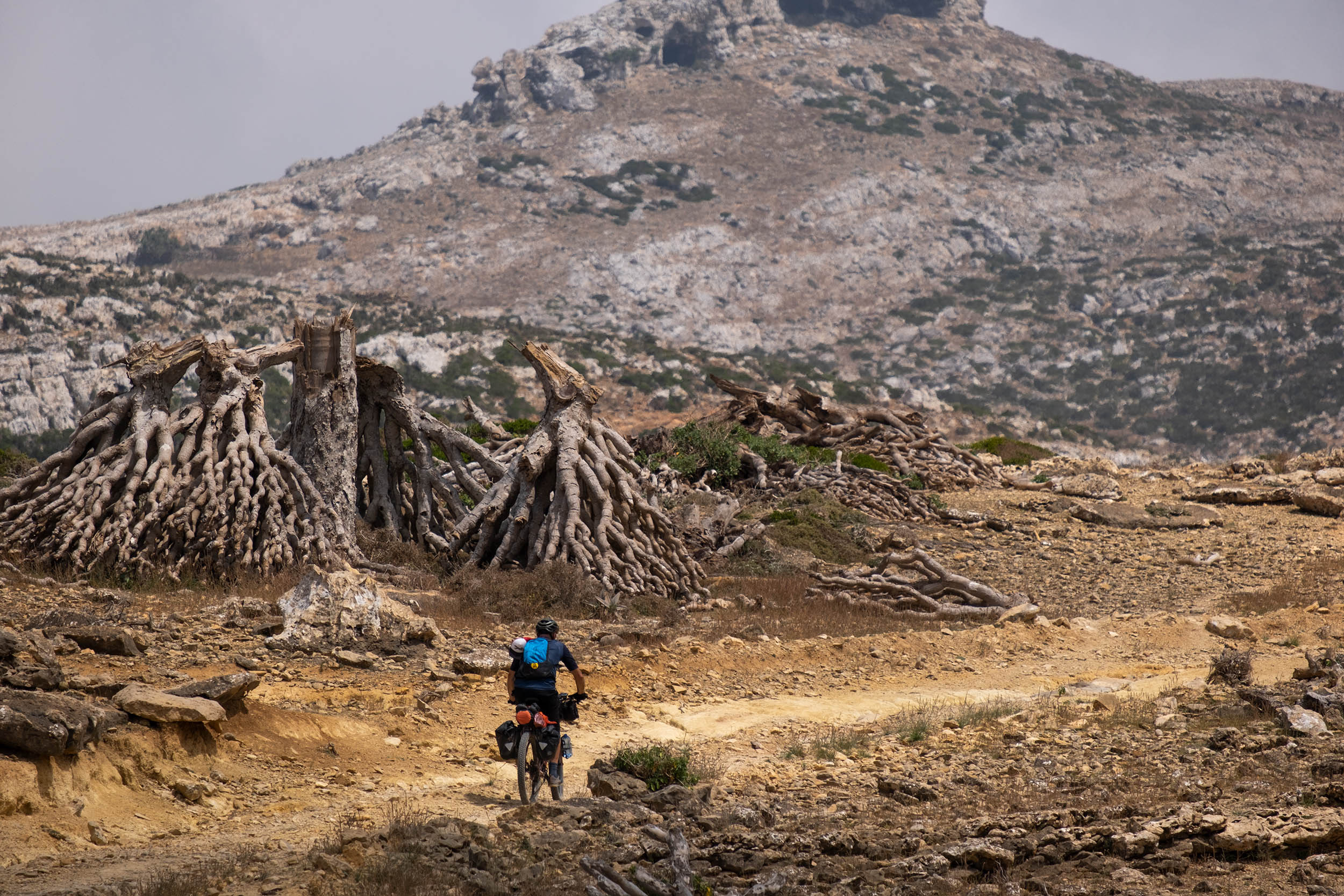
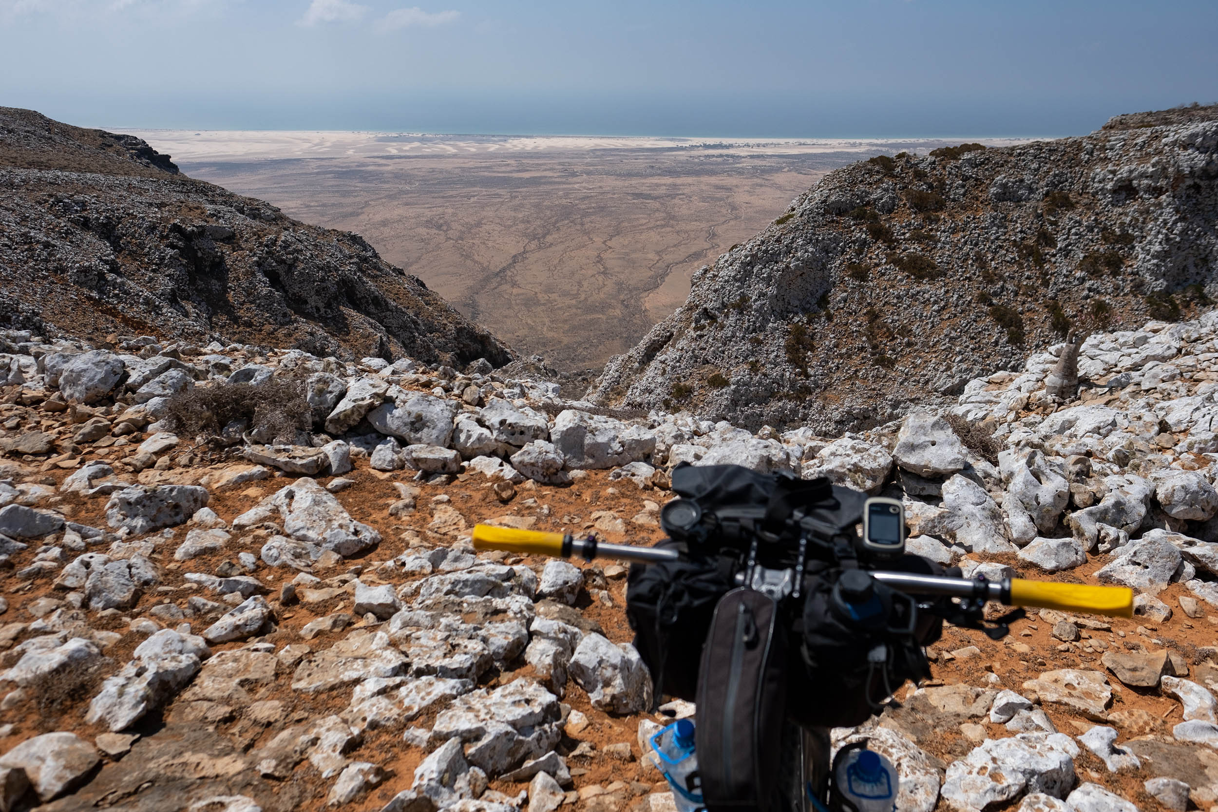
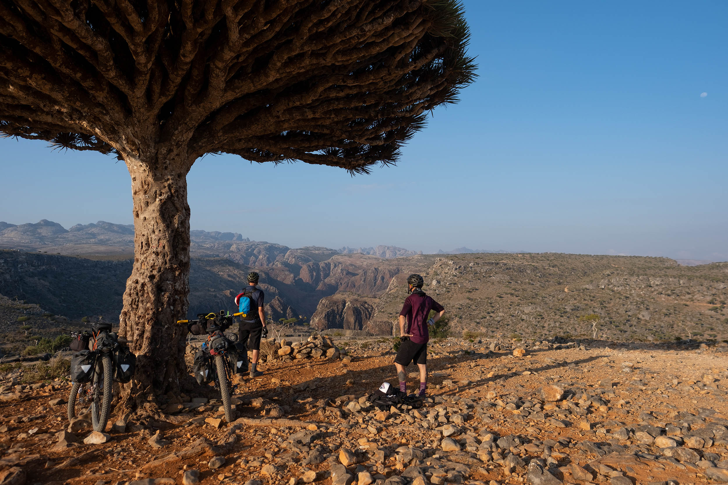
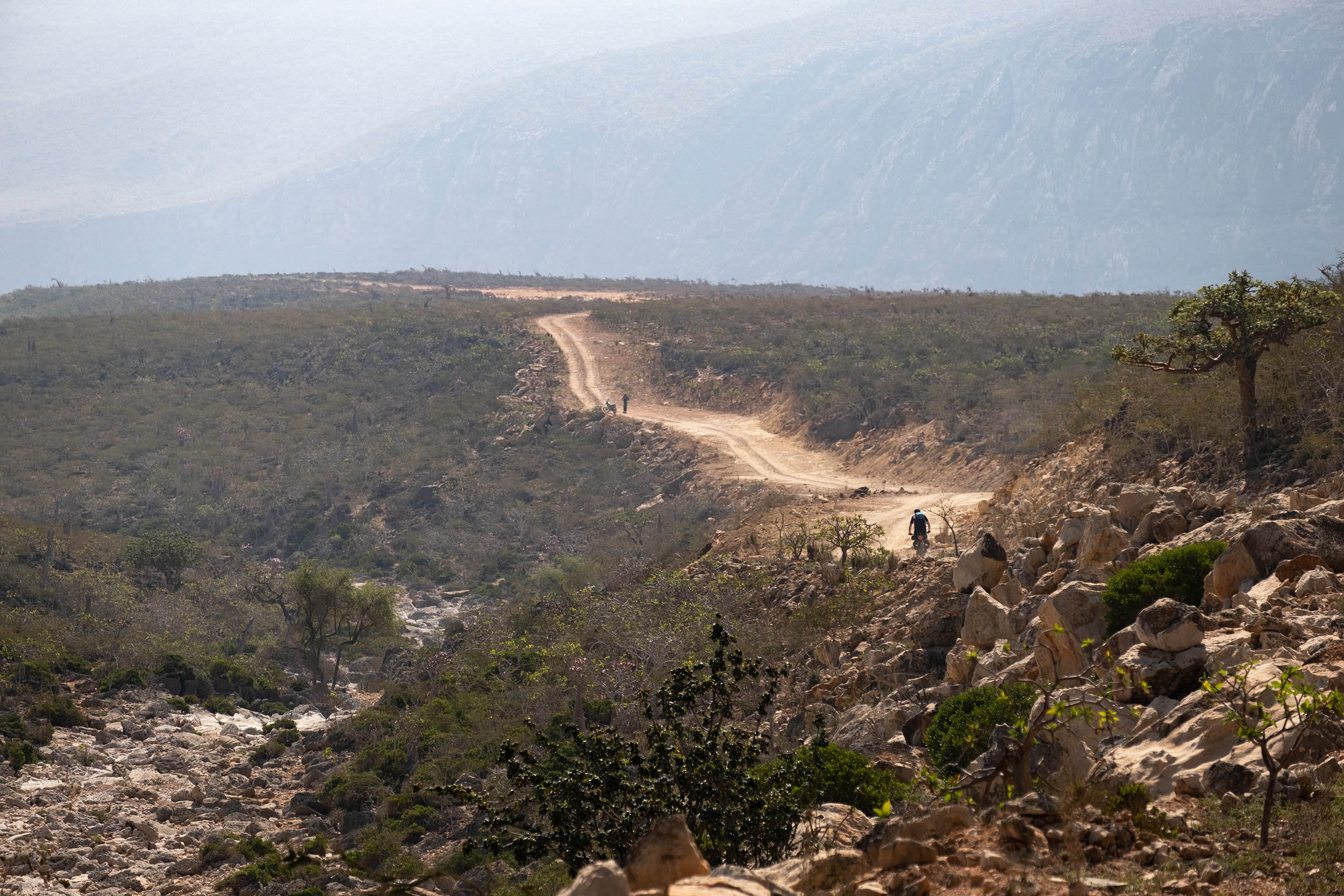
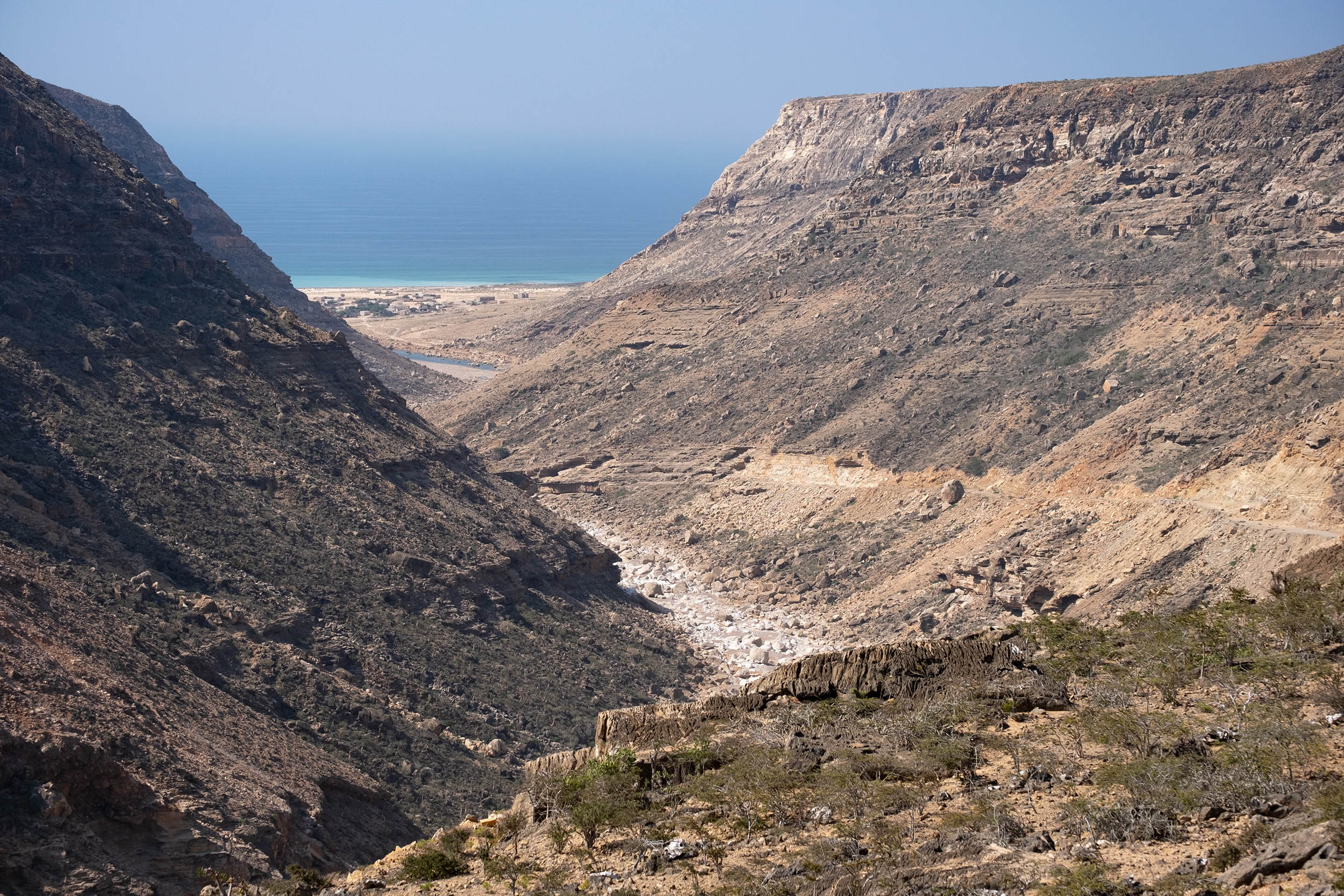
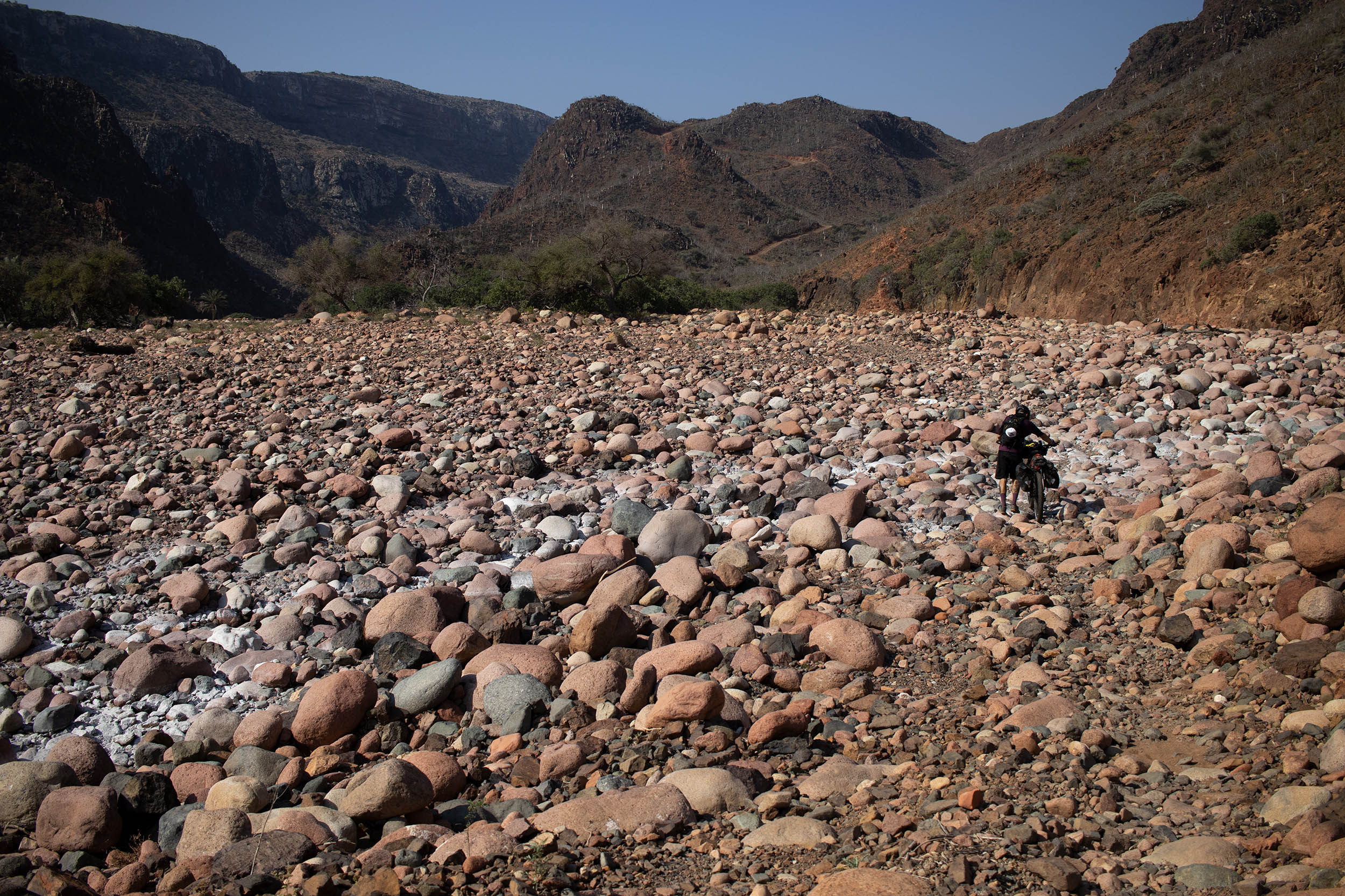
Through a tricky and risky downhill into Kalisan Canyon (check it out “Route info”), the route flows on the south coast where stunning beaches are flanked by impressive cliffs overlook the Indian Ocean. A series of short but super steep uphills and rough downhills leads to the Diksam Plateau, where the Firmihin Forest, the impressive Wadi Dirhur Canyon, and the dramatic peaks of Hajhir Mountains in the background paint a stunning landscape that seems like something out of the Mesozoic Era. The plateau is home to the highest concentration of the iconic Dragon Blood Trees on the island (and therefore, the world). A legend tell us that the plant was born of the blood spilled during a cruel fight between a dragon and an elephant. The name “Dragon Blood” comes from the reddish resin, cinnabar, contained in the leaves and in the cortex.
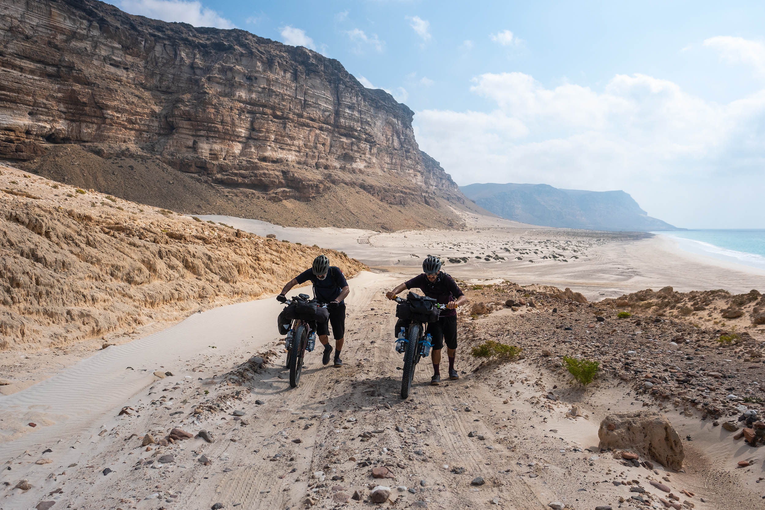
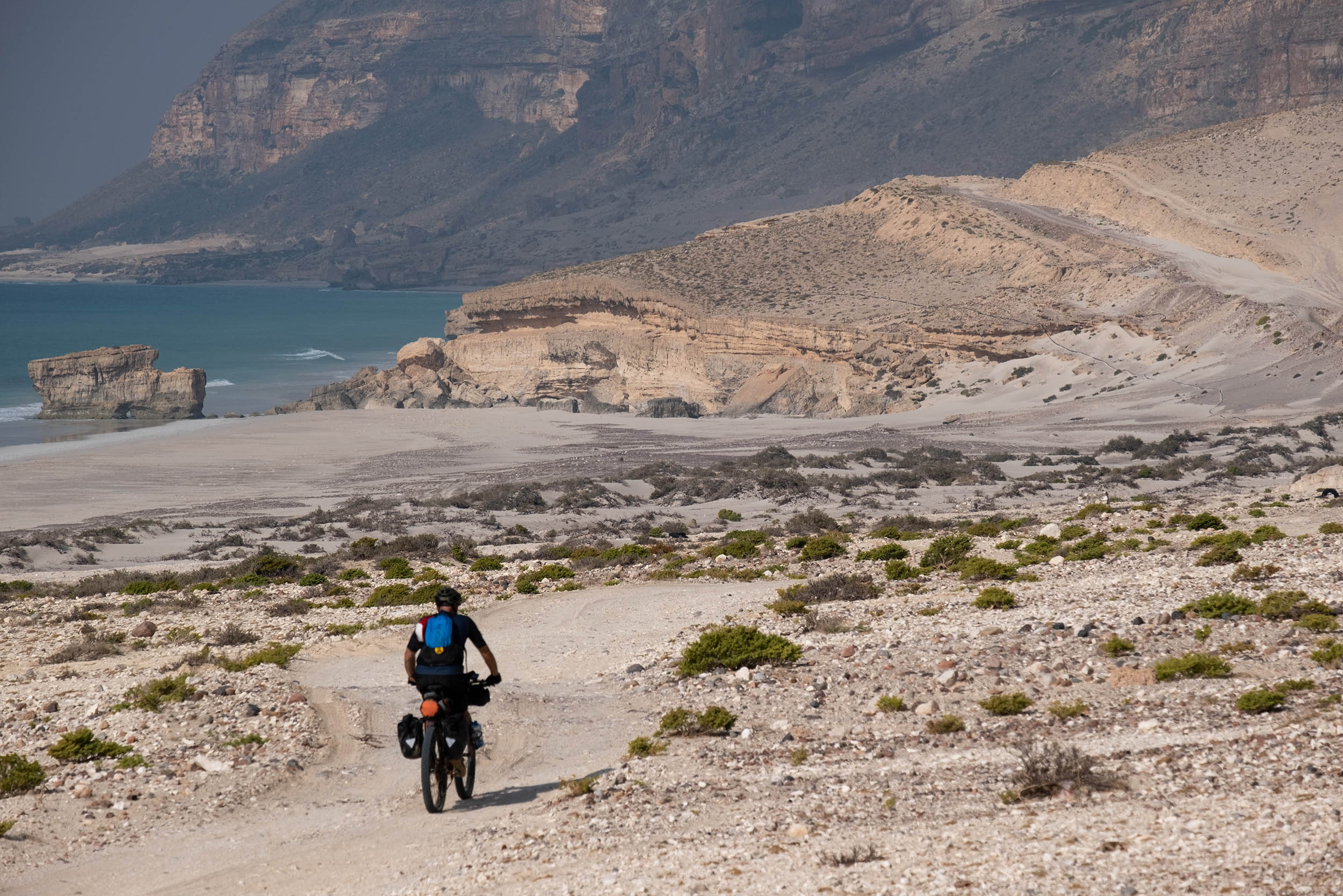
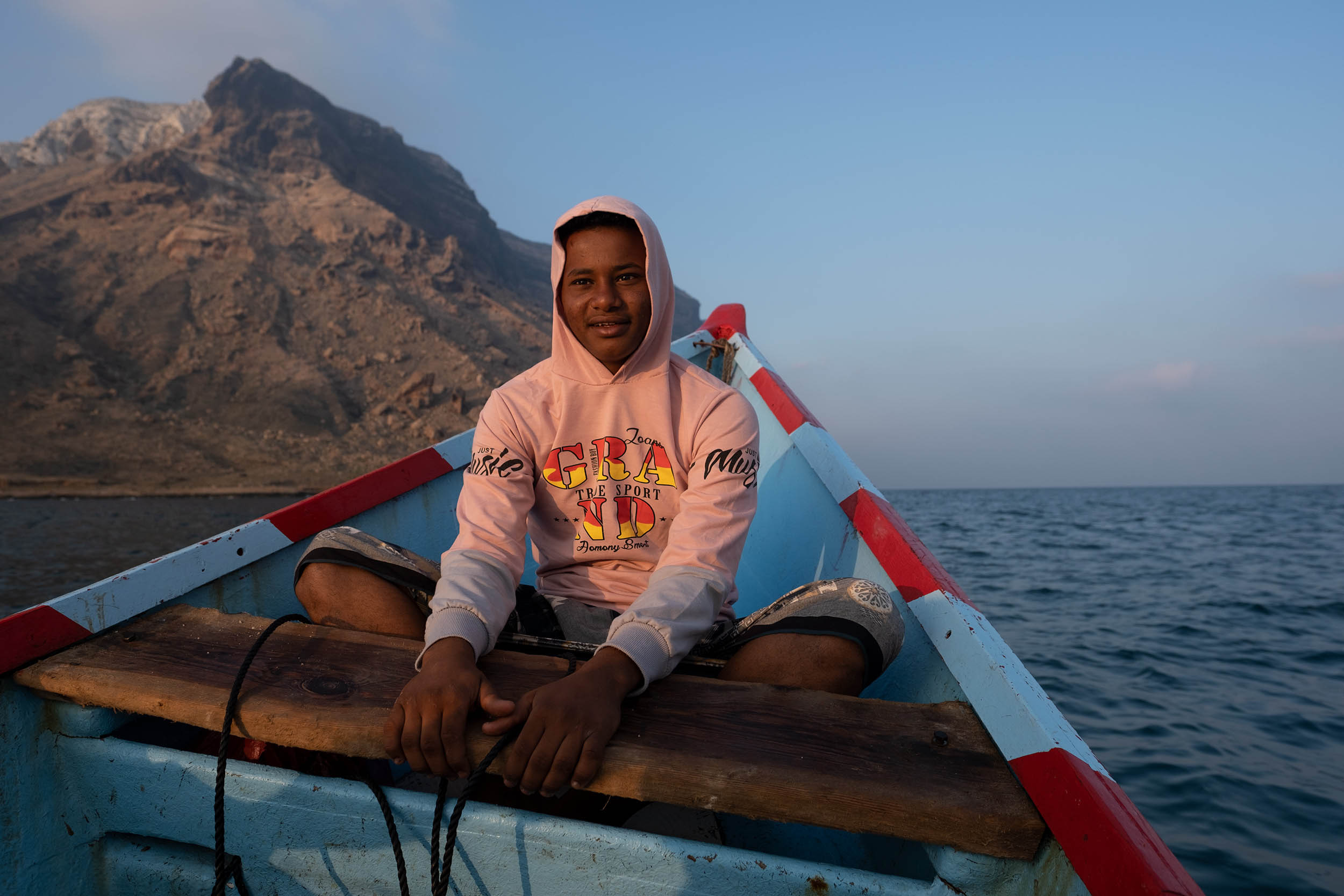
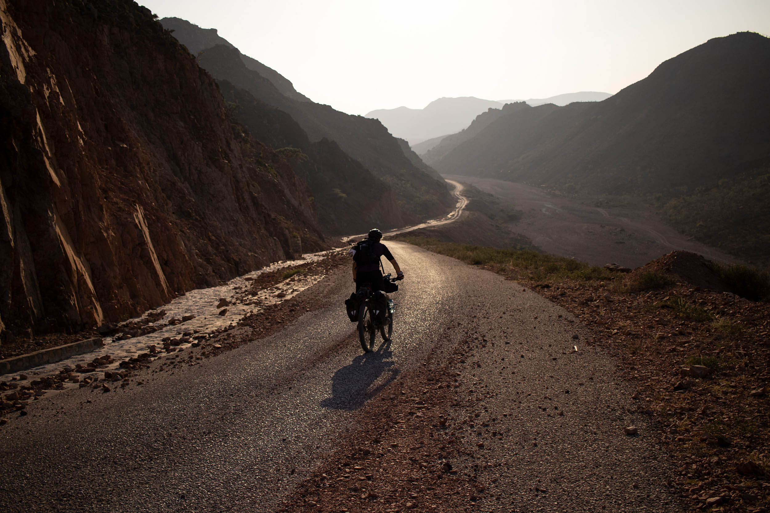
The Dragon Blood Trail follows jeep tracks and dusty roads and reaches Qalansyah, a small town on the west coast, where you will need to get on a fishing vessel (check out “Route info”) to reach Qabahen, a small and isolate village that lies 23 kilometers (14 miles) south in the Shoab Bay. Back on dry land, the route crosses an otherworldly desert wilderness characterized by unusual rock formations and some goatherds’ huts. The challenging and often hostile environment and the lack of water/food resupply along the route make the Dragon Blood a challenging journey and a real adventure.
ROUTE DIFFICULTY
This route has been awarded a difficulty rating of 9 out of 10 and is not to be undertaken lightly. The search for water can easily become an obsession all along the route, and the necessity to filter and purify it make things even more difficult. Diarrhea and stomach problems can lead to serious complications, especially in the remote areas, if you don’t take the right precautions. A heavily laden bike combined with super rough terrain with sharp stones and some sandy stretches makes this route more challenging than the cumulative elevation gain suggests. Note that this route is easier to attempt with a plus bike or a fat bike; a gravel bike is not an option.
All in all, there’s not a significant amount of elevation gain, but this route requires good physical fitness and aptitude for traveling in a harsh semi-desert environment. The route has rocky and sandy roads and short but super steep climbs with some tricky exposed passages. The logistics are extremely difficult considering you have to use an unconventional means to buy a flight ticket (via WhatsApp) to a hard-to-reach destination. Also, there’s only one food resupply (in Qalansyah), and water resupply can be difficult, especially during dry season of January-March. Bedouins can help you with water and usually invite you to share their lunch in the few villages along the route, but that shouldn’t be relied on.


Submit Route Alert
As the leading creator and publisher of bikepacking routes, BIKEPACKING.com endeavors to maintain, improve, and advocate for our growing network of bikepacking routes all over the world. As such, our editorial team, route creators, and Route Stewards serve as mediators for route improvements and opportunities for connectivity, conservation, and community growth around these routes. To facilitate these efforts, we rely on our Bikepacking Collective and the greater bikepacking community to call attention to critical issues and opportunities that are discovered while riding these routes. If you have a vital issue or opportunity regarding this route that pertains to one of the subjects below, please let us know:
Highlights
Must Know
Camping
Food/H2O
Resources
- Exploring one of the most isolated and infrequently visited places on the planet.
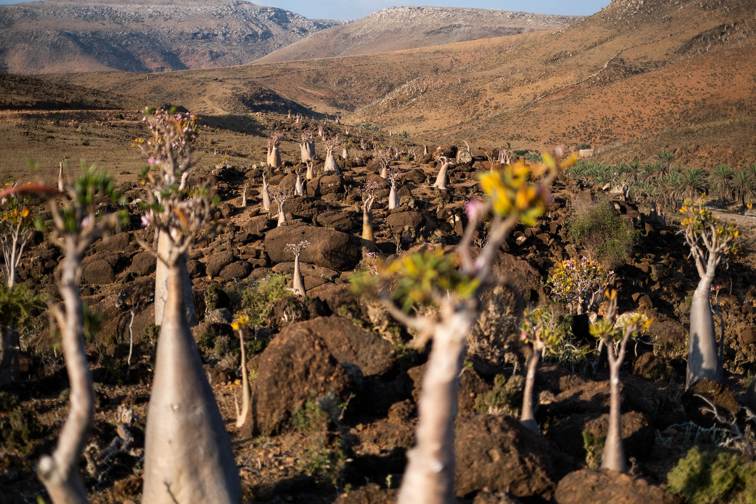
- A chance to see many rare and endemic species of plants found nowhere else in the world as the iconic Dragon Blood Tree (Dracaena Cinnabari) and the Socotra Desert Rose or Bottle Tree (Adenium Obesum Socotranum).
- Stunning views of otherworldly landscapes with pinnacles of Haggier (Hajhir) Mountains in the background.
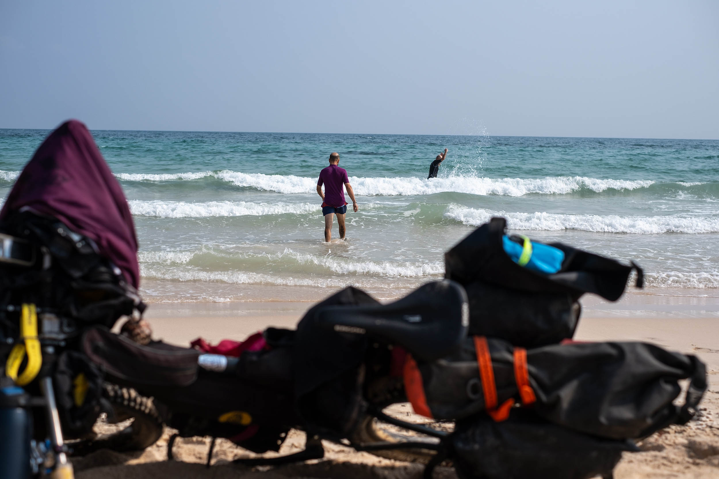
- Swimming in the wadi’s deep pools to refresh yourself and escape the midday heat.
- The impressive sight of Wadi Dirhur, a canyon gashed into the limestone plateau separating Diksam Plateau from the Firhmin Forest.
- The breathtaking beauty of the Detwah Lagoon characterized by turquoise water and snow-white sand.
- The chance to spot some dolphins jumping alongside the boat during your sea transfer from Qalansiyah to Shoab Beach.
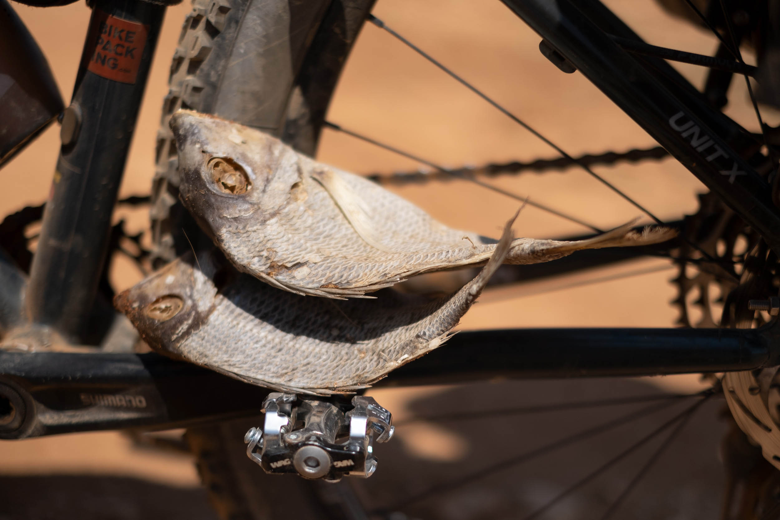
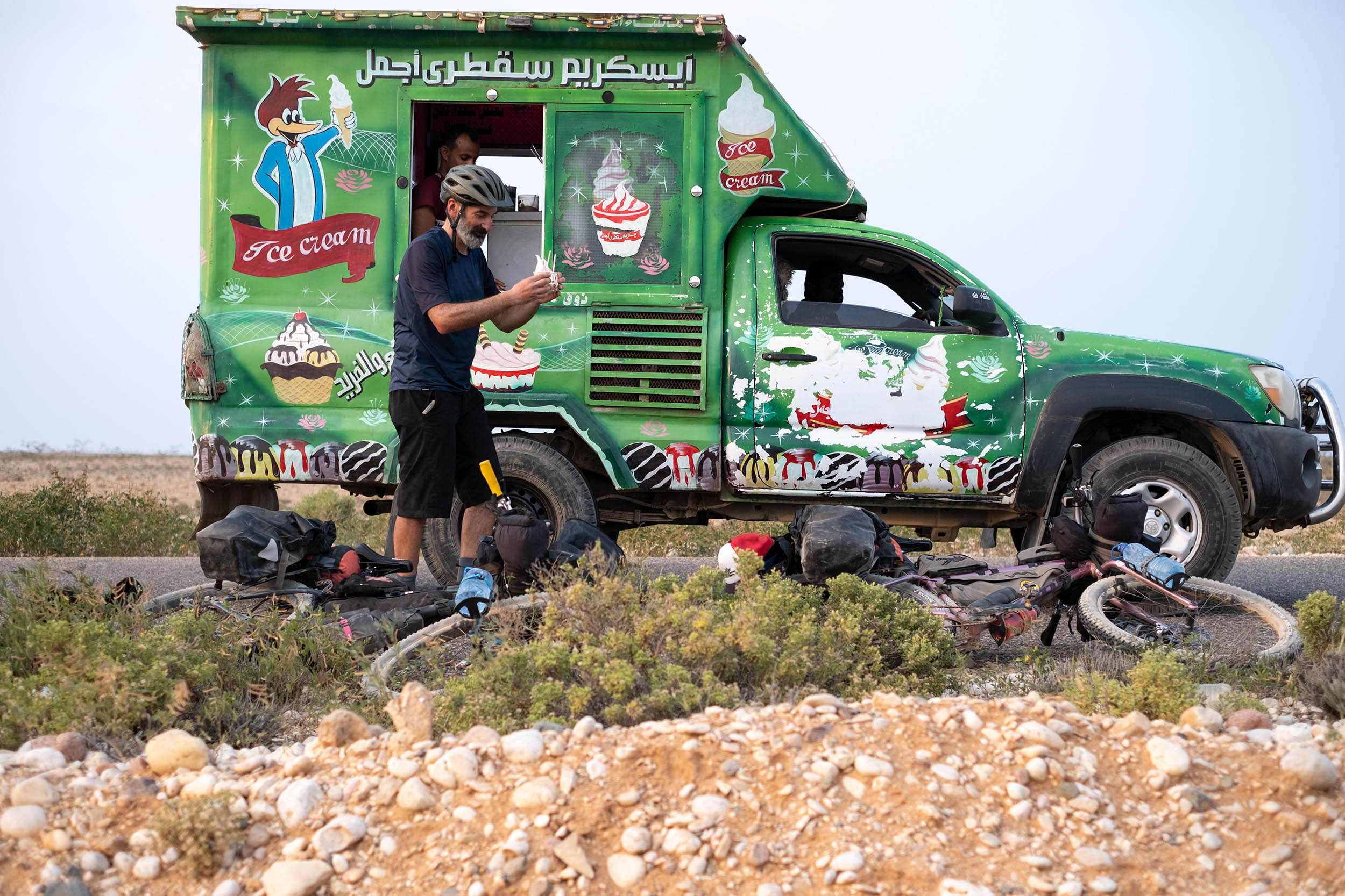
- The chance to have an ice cream (or more) from a truck with Woody-Woodpecker painted on the side just before the end of the route. That’s not a mirage!
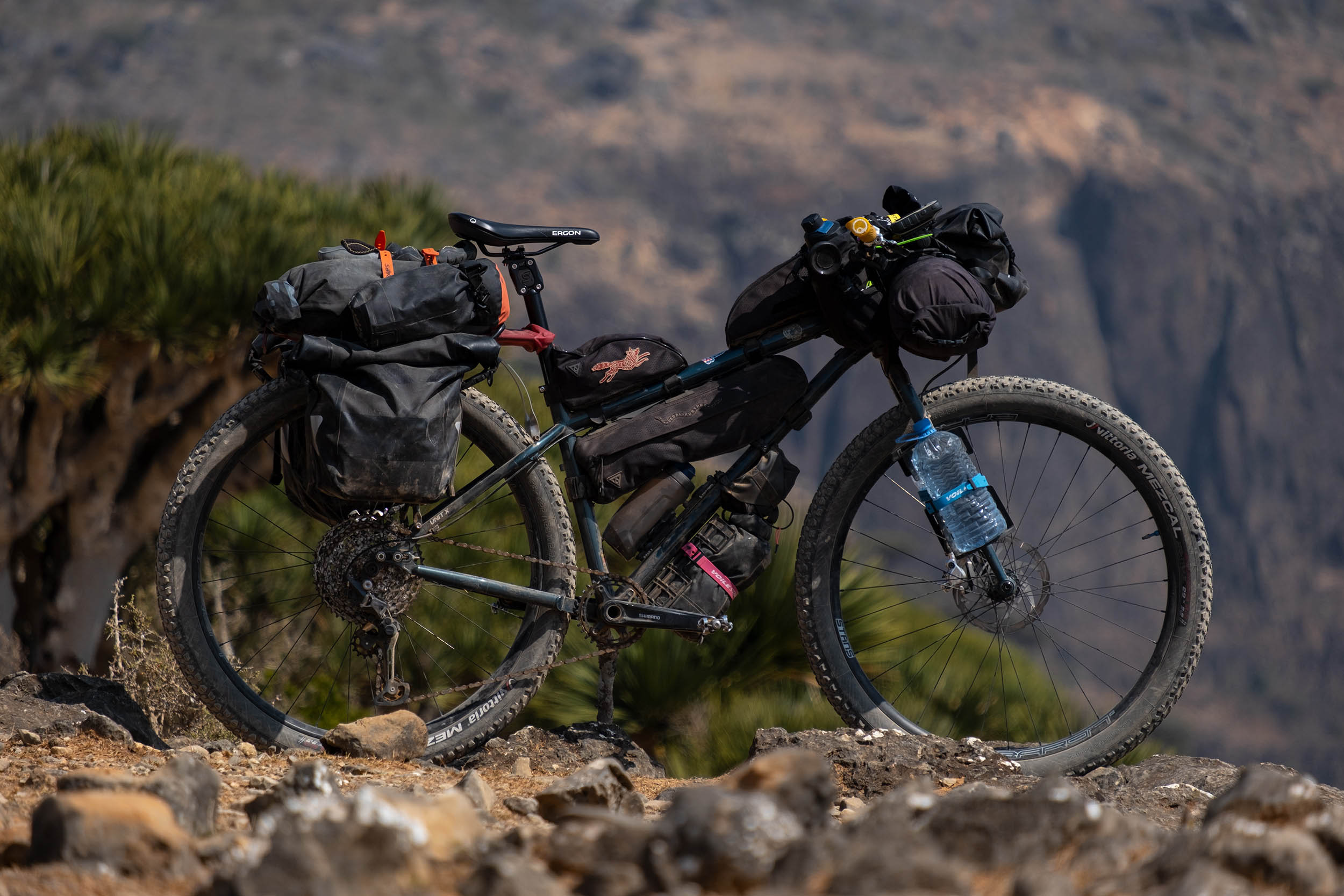
- Bikes: we rode Kona Unit Xs with rigid forks and 2.6″ Vittoria Mezcal tires. This setup worked well. Front suspension will be welcome on non-plus/fat bike rigs, especially for riding in the remotest areas where the terrain is really rugged.
- Safety: Note that as of July 2023, the US Department of State has issued a “Level 4: Do Not Travel” warning for all of Yemen due to the ongoing civil war. Please visit this page for current details.
- This route is best tackled in the dry season, between mid/late January and early March, when the weather is generally dry and relatively cool, plus, the seawater is also calmer and clearer. As an added bonus, the iconic Bottle Trees also begin to bloom in March, revealing picturesque pink. October is also generally a good time to ride this route. Expect some rainy days that fill the wadis with clean and fresh water and make the landscapes lush.
- You can reach Socotra with a weekly direct flight from Abu Dhabi. It’s a governmental charter flight, and they do not offer online booking. Flight reservation and visas can be requested only by a local tour operator. We contacted ILoveSocotra.com, and Samed, the Soqotri guy behind the company, was super friendly and helped us also with airport transfer, accomodation, and food supply.
- There are only two hotels in Hadibo, the capital of Socotra, but we preferred to stay at Heathrow Hotel (h.h@tcmsuk.com). It’s near the airport and 13 kilometers (8 miles) from Hadibo and offers some rooms with private bathrooms, WiFi, and A/C. They can also store bike trolleys/boxes.
- Pressured gas canisters are not available in Socotra. We used a multi-fuel stove (XGK EX Stove by MSR) to cook, since fuel is easy to find in markets or directly in the streets of Hadibo (ask for “ghaz” or “benzina”).
- There are no ATMs on the island and credit cards aren’t accepted anywhere, so you need to carry cash. The currency used is the Yemeni Rial (YR), but USD is the most widely accepted foreign currency and easiest to exchange on the island. Euros are also accepted. Rial is the only currency accepted in the highlands and rural areas.
- SIM cards can be purchased at Abu Dhabi airport, but consider that most of the route has no signal coverage. A communicator satellite (we used a Garmin InReach Mini 2) can help you staying in touch with your family or send out a request for help if you’re in trouble in the the most isolated parts of the route.
- A solar panel and a power bank are recommended for charging devices and camera batteries, since electricity is available only in Hadibo, Qalansiyah, and at Heathrow Hotel near the airport. You have the chance to recharge your phone and small devices at Keabanni Campsite on Diksam Plateau.
- Diarrhea and food-borne illnesses are not uncommon ailments of travelers in Socotra. Make sure to pack Imodium and a broad-spectrum antibiotic.
- Stay away from camels; they can be aggressive.
- The downhill into the Kalysan Canyon is a bit tricky and includes some exposed stretches that can be challenging, especially with heavily laden bikes. The passage is shown in our Socotra film (below) at 2:50.
- Be prepared for some hike-a-bike along the route. Short but super-steep climbs in the highlands and sandy roads along the coast will force you to push your bike.
- This route involves a sea transfer with a fishing vessel from Qalansiyah to Qabahen, a small village on the Shoab Bay in the southeast coast. Samed of ILoveSocotra.com can help you to arrange the transfer.
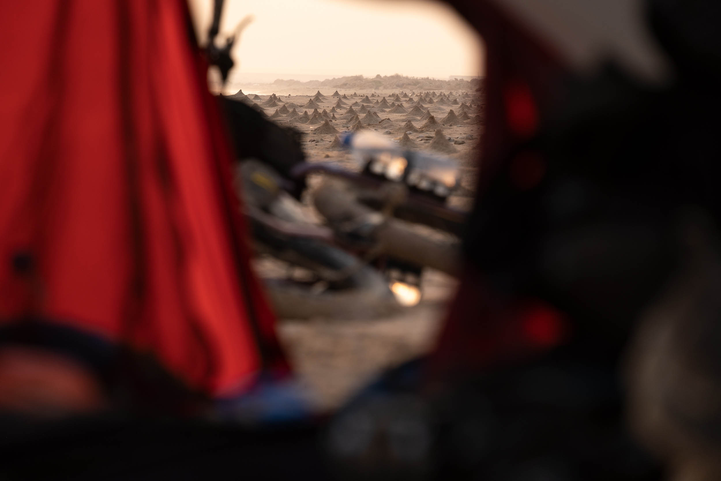
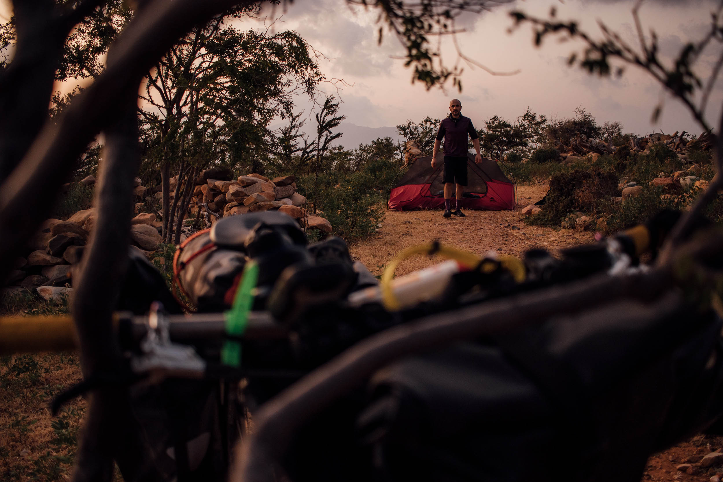
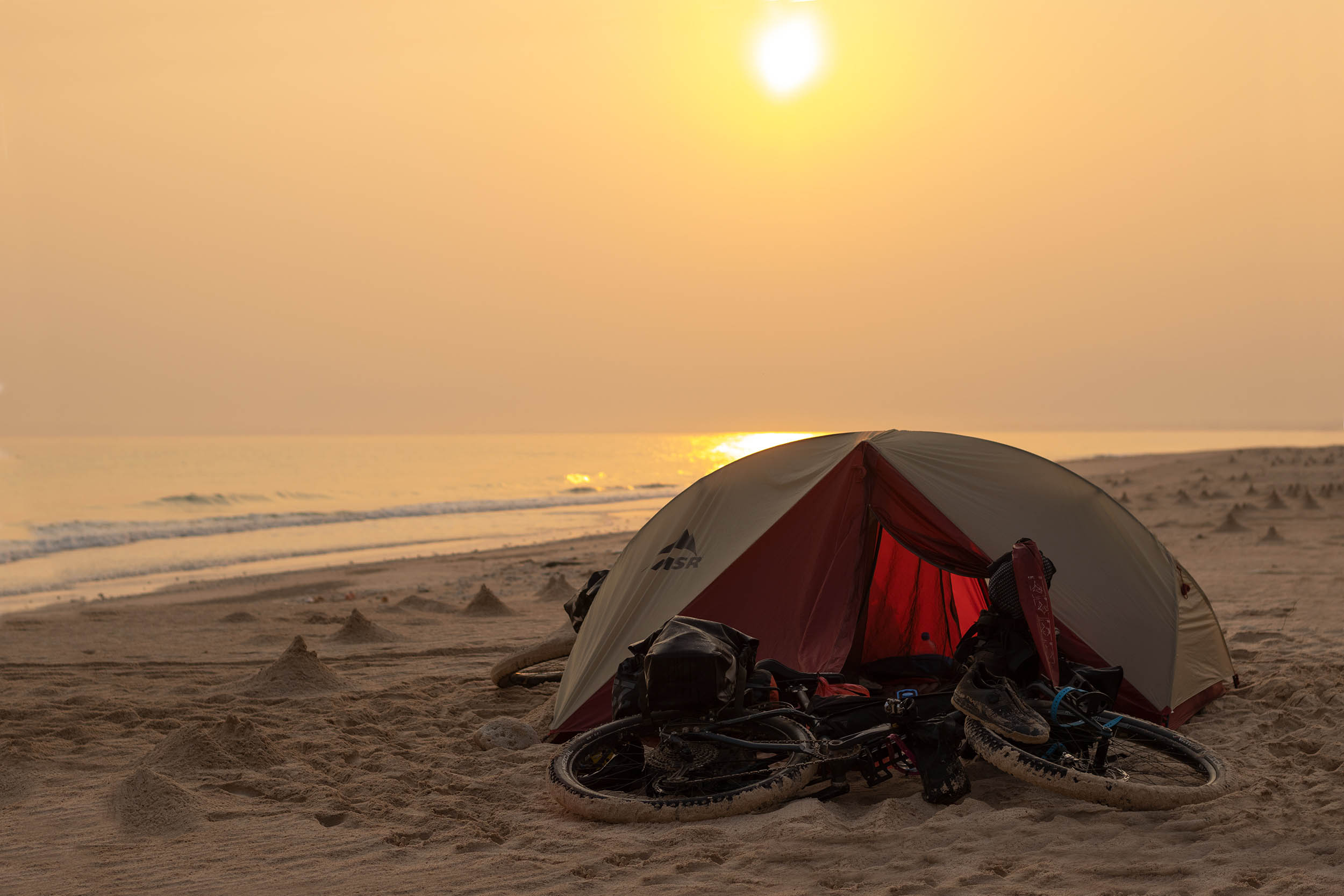
- Wild camping will never be a problem on the island. If you decide to camp on the beach, make sure your tent is far enough away from the ocean to avoid getting caught by the high tide.
- Keabanni is a campsite with basic lodging on Diksam Plateau where you can take a stop to rest, drink chai, take a shower, and eat traditional Soqotri food.
- There is no garbage collection and disposal system in Socotra. It would be good to minimize plastic waste and dispose of it where plastic can be recycled. We brought back home some plastic bags and the bottles we used to carry the water along the route. #Leavenotrace.
- The only drinkable water on the island is the bottled one sold in markets of Hadibo (close to the start of the route) and Qalansiyah.
- Wadis (rivers in the canyons) and some small villages are the only chances for water resupply along the route, and in both cases, water has to be filtered and purified. We used a MSR TrailShot pocket-sized water filter and a Katadyn Steripen Adventurer Opti UV Water Purifier to avoid using chlorine tablets.
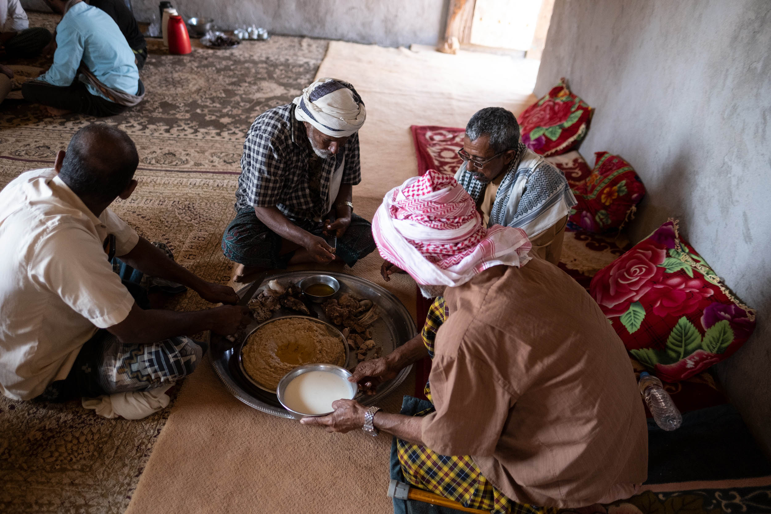
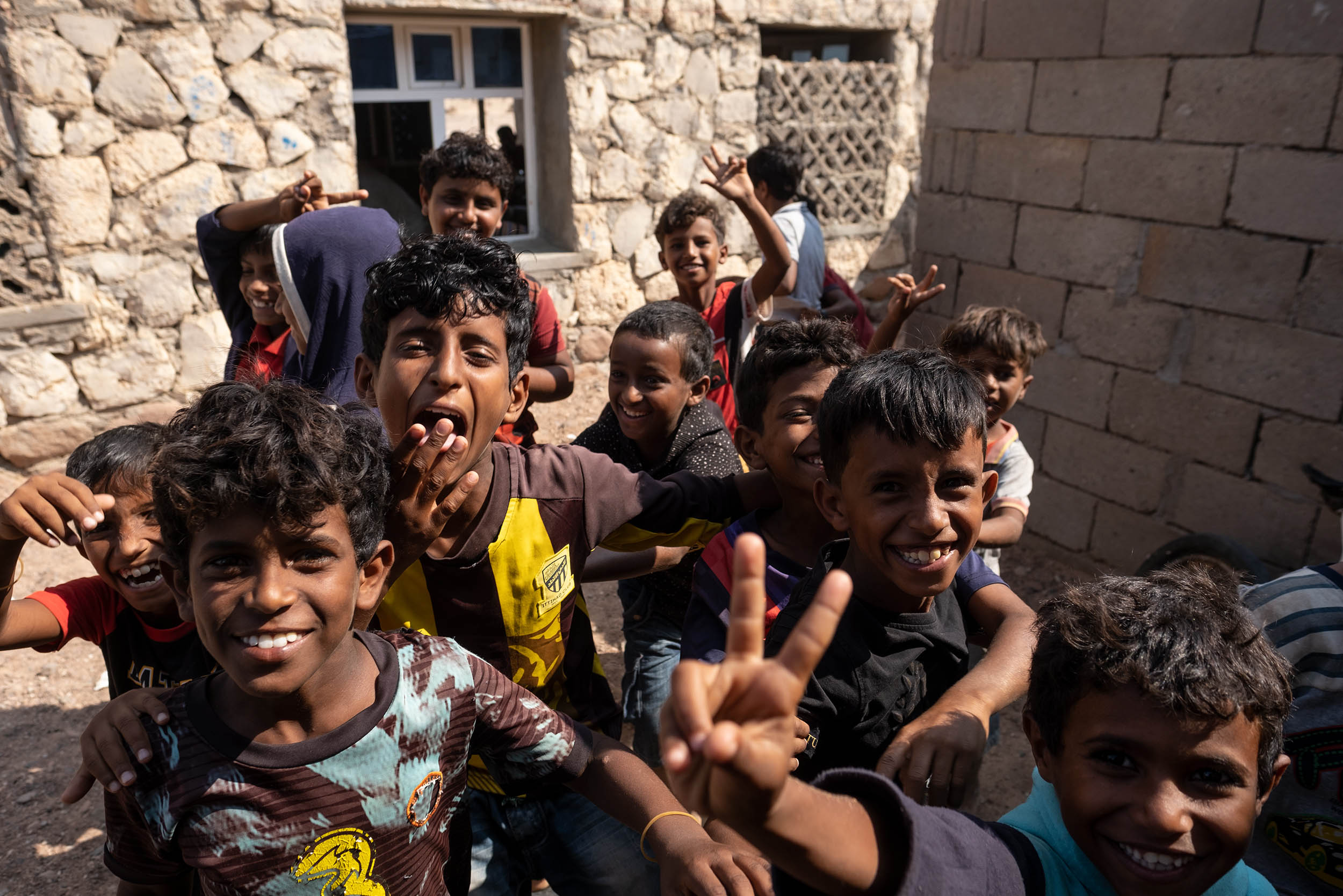
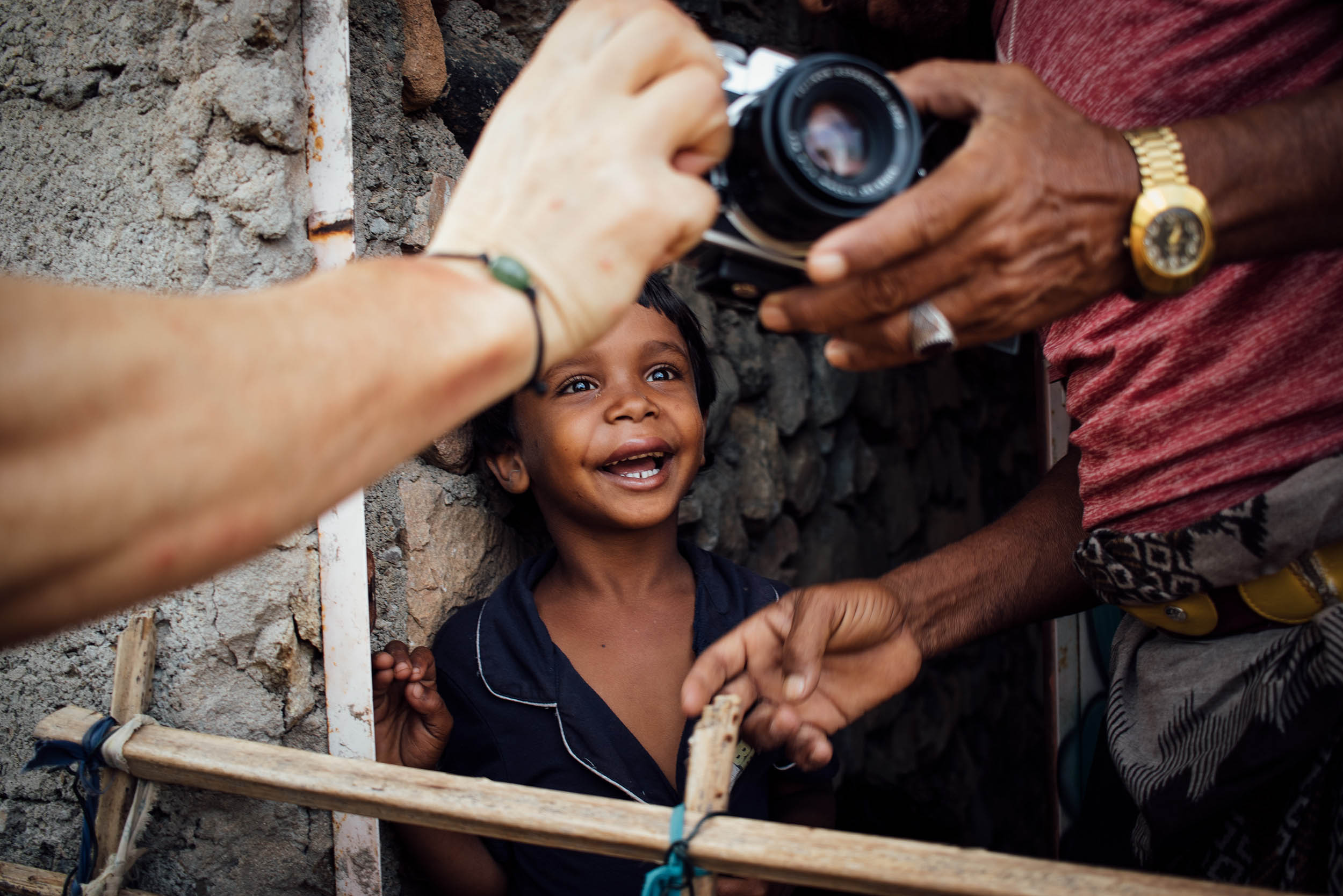
- Be prepared for some unplanned stops in rural areas, where people are super friendly and invite you in their home to rest, drink sweetened chai, and share traditional food based on rice, goat meat, and hummus.
- Food resupply can be found only in markets in Qalansiyah, the second largest town on the island.
- As Socotra is hot and dry, make sure to stay hydrated. We carried 5L of water at any one time, three of which were on the front fork.
Additional Resources
- Visit MontanusWild.com for the full set of photos from this trip

Terms of Use: As with each bikepacking route guide published on BIKEPACKING.com, should you choose to cycle this route, do so at your own risk. Prior to setting out check current local weather, conditions, and land/road closures. While riding, obey all public and private land use restrictions and rules, carry proper safety and navigational equipment, and of course, follow the #leavenotrace guidelines. The information found herein is simply a planning resource to be used as a point of inspiration in conjunction with your own due-diligence. In spite of the fact that this route, associated GPS track (GPX and maps), and all route guidelines were prepared under diligent research by the specified contributor and/or contributors, the accuracy of such and judgement of the author is not guaranteed. BIKEPACKING.com LLC, its partners, associates, and contributors are in no way liable for personal injury, damage to personal property, or any other such situation that might happen to individual riders cycling or following this route.
FILED IN (CATEGORIES & TAGS)
The Middle East
Please keep the conversation civil, constructive, and inclusive, or your comment will be removed.